By Team INVC | INVC NEWS
Published: September 2, 2026 |09 : 36 AM IST
NEW DELHI, India | September 2, 2026 —
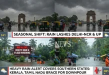
Weather Today September 2 2026 brings another active monsoon day across large parts of India, with the India Meteorological Department warning of very heavy rainfall in Uttarakhand and heavy rain, thunderstorms and lightning across several parts of North, Central and East India.
Delhi-NCR, Haryana, Punjab, Uttar Pradesh, Himachal Pradesh, Madhya Pradesh, Chhattisgarh, Bihar, Jharkhand, Odisha and West Bengal are among the regions facing significant rain activity on Wednesday.
The latest weather pattern is being supported by an active low-pressure system and associated troughs stretching across eastern and northern India. As a result, commuters, travelers and residents in vulnerable areas could face waterlogging, traffic disruption, reduced visibility and localized flooding.
Uttarakhand Faces Very Heavy Rain Risk
Uttarakhand remains one of the most closely watched states today.
The IMD has forecast very heavy rainfall at isolated places in Uttarakhand on September 2, along with thunderstorms and lightning.
Rainfall activity is expected to remain widespread across the Himalayan state through the coming days, increasing concerns over landslides, falling rocks, swollen streams and disruption on mountain roads.
People traveling through hill districts should remain cautious, particularly in areas vulnerable to landslides and flash flooding.
Local weather and disaster-management advisories should be checked before starting long road journeys in the hills.
Delhi-NCR: Rain and Thunderstorms May Disrupt Travel
Delhi and neighboring areas could see another wet day.
The IMD has issued a heavy-rain warning for Haryana, Chandigarh and Delhi on September 2, along with the possibility of thunderstorms and lightning.
Rain activity is expected to strengthen further across Delhi-NCR during September 3 and September 4.
Periods of rain could create temporary waterlogging on low-lying roads and slow traffic during busy commuting hours.
Delhi is expected to remain cloudy to rainy through much of the day, with temperatures broadly around the mid-20s Celsius in the cooler hours and rising into the low 30s Celsius.
Residents traveling through Delhi, Noida, Gurugram, Ghaziabad and Faridabad should allow additional travel time where heavy showers develop.
Uttar Pradesh Rain Alert: East and West UP in Focus
Uttar Pradesh is also facing an active spell of monsoon weather.
The IMD has warned of heavy rainfall in East Uttar Pradesh on September 2, while West Uttar Pradesh could see heavy rainfall through September 5.
Thunderstorms and lightning are also possible across parts of the state.
Lucknow, Kanpur and several areas of eastern and western Uttar Pradesh could experience periods of rain, although rainfall intensity will vary considerably from district to district.
People should avoid taking shelter beneath isolated trees or weak structures during thunderstorms.
Himachal Pradesh Could See Heavy Rain
Himachal Pradesh is likely to receive fairly widespread to widespread rainfall.
The IMD has forecast isolated heavy rain over Himachal Pradesh on September 2 and September 3.
Mountain roads may become slippery, while heavy showers can raise the risk of localized landslides and temporary road closures.
Tourists should therefore follow local traffic and weather advisories before entering vulnerable mountain routes.
Madhya Pradesh, Chhattisgarh Brace for Intense Spell
Central India is another major area of concern.
Widespread rainfall is expected across West Madhya Pradesh, while East Madhya Pradesh, Vidarbha and Chhattisgarh will also experience significant monsoon activity.
The IMD has forecast heavy rain at isolated places in West Madhya Pradesh and Vidarbha on September 2.
More importantly, very heavy rainfall is possible in East Madhya Pradesh and Chhattisgarh today, with the intense spell shifting across parts of central India over the next few days.
Thunderstorms and lightning could accompany the rainfall.
Agricultural areas may benefit from moderate rain, but intense showers in a short period can create waterlogging and damage in poorly drained fields.
Bihar, Jharkhand, Odisha and West Bengal Get More Rain
Eastern India remains under the influence of an active weather system.
Fairly widespread to widespread rain is expected over Bihar, Jharkhand and Odisha today, while Gangetic West Bengal is also likely to experience widespread rainfall.
Heavy rain is possible at isolated places over Gangetic West Bengal, Odisha and Jharkhand on September 2.
Bihar could receive isolated heavy rainfall through September 4.
Thunderstorms, lightning and gusty winds could accompany some rain spells across the region.
In Odisha, winds associated with thunderstorms may become strong in isolated locations, making outdoor activity potentially hazardous during severe cells.
Northeast India Set for Prolonged Wet Spell
The Northeast is also entering an extended period of rainfall.
Arunachal Pradesh, Assam and Meghalaya are expected to receive fairly widespread to widespread rain through September 8.
Nagaland, Manipur, Mizoram and Tripura could also experience widespread rainfall through September 6.
Isolated heavy rainfall is likely across several northeastern states during this period, while Arunachal Pradesh may face a more intense spell later in the week.
Residents in flood-prone and landslide-prone districts should closely follow local warnings.
Konkan, Goa and Southern India Also See Monsoon Activity
Fairly widespread to widespread rainfall is forecast across Konkan and Goa through September 8.
Scattered rainfall is also expected over Gujarat Region, Madhya Maharashtra, Marathwada and Saurashtra and Kutch.
In southern India, rain is likely across Kerala, coastal Karnataka, Telangana, Andhra Pradesh, Tamil Nadu and parts of Karnataka.
Thunderstorms, lightning and gusty winds could affect parts of Rayalaseema, Karnataka and Telangana.
Coastal Andhra Pradesh may also experience strong surface winds.
What Is Driving the Rain?
A well-marked low-pressure area associated with the Bay of Bengal weather system has been influencing parts of eastern India.
Associated atmospheric circulations and troughs are helping channel moisture into eastern, central and northern parts of the country.
This setup is keeping monsoon conditions active even as rainfall distribution remains highly uneven across India.
The weather pattern could continue moving west-northwestward, supporting additional rainfall over central and northern regions.
September Rainfall Outlook Adds Another Concern
Although several regions are experiencing intense rain right now, the broader September monsoon picture remains important.
India entered September after a weak August rainfall performance, raising concerns about uneven rainfall distribution and soil moisture in agricultural regions.
Therefore, isolated episodes of very heavy rain do not necessarily mean that rainfall will be uniformly above normal across the country.
For farmers, the timing and geographic distribution of rain will remain crucial as kharif crops move through important growth stages.
Safety Advisory for Heavy Rain and Thunderstorms
Residents in rain-affected regions should avoid unnecessary travel through flooded roads and underpasses.
During thunderstorms, people should move indoors and stay away from open fields, isolated trees, electric poles and exposed high ground.
Drivers should reduce speed during heavy rain because visibility can deteriorate rapidly.
People living close to rivers, streams, steep slopes or known landslide zones should follow instructions from district authorities.
Weather conditions can change quickly, particularly during active monsoon systems.
What to Expect Next
The wet spell will not disappear immediately.
Rainfall is expected to remain active across Uttarakhand, parts of Uttar Pradesh, Delhi-NCR, Punjab and central India over the next several days.
For Weather Today September 2 2026, Uttarakhand remains the key very-heavy-rain zone, while Delhi-NCR, Uttar Pradesh and several central and eastern states face a combination of heavy rain, thunderstorms and lightning.
The safest approach is to monitor local warnings and avoid unnecessary movement whenever intense thunderstorms or waterlogging develop.