NEW DELHI, August 15, 2026
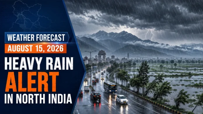
Weather Forecast August 15, 2026: The southwest monsoon is expected to remain active across northern India on Saturday, bringing cloudy skies, intermittent rain, thunderstorms and gusty winds to several states.
Light to moderate rainfall is likely across Jammu and Kashmir, Ladakh, Himachal Pradesh, Uttarakhand, Punjab, Haryana, Chandigarh, Delhi, Uttar Pradesh, Rajasthan and Bihar. Some locations could receive heavy rainfall.
The greatest risk remains over the Himalayan region, where intense rain may trigger landslides, flash floods, falling rocks and a rapid increase in the water levels of rivers and mountain streams.
Residents and travelers should monitor local alerts because the timing and intensity of thunderstorms can vary sharply, even between neighboring districts.
Heavy rain warning for Himachal Pradesh and Uttarakhand
Himachal Pradesh and Uttarakhand could experience heavy to very heavy rainfall at isolated locations, particularly in mountainous and foothill districts.
Continuous rain may destabilize slopes, damage vulnerable roads and cause sudden increases in stream levels. Travel delays are possible along mountain highways, while landslides could temporarily block routes.
Tourists and pilgrims should check the latest road and weather conditions before beginning their journeys. Travel near steep slopes, waterfalls, rivers and swollen streams should be avoided during intense rain.
People staying in low-lying valleys should follow instructions issued by local administrations and disaster-management authorities.
Jammu and Kashmir and Ladakh weather
Several parts of Jammu and Kashmir may receive light to moderate rain accompanied by thunderstorms. Isolated locations could experience brief, intense spells and lightning.
Rain in hilly terrain may lead to slippery roads, falling rocks and localized disruption. Drivers should maintain a safe speed and avoid traveling through waterlogged or unstable sections.
Conditions may vary across Ladakh, with the possibility of localized showers and thunderstorms. Travelers should confirm forecasts for their precise route, especially when crossing high-altitude roads.
Punjab, Haryana and Chandigarh forecast
Cloudy skies and intermittent rainfall are expected across Punjab, Haryana and Chandigarh.
Thunderstorms could produce gusty winds of approximately 40 to 60 kilometers per hour in isolated areas. Loose objects, temporary structures, tree branches and outdoor advertising panels may become hazardous during stronger gusts.
Rainfall may be uneven, with some areas receiving short but intense showers while nearby locations experience lighter rain.
Farmers should avoid working in open fields during lightning and secure harvested crops, agricultural equipment and livestock shelters ahead of severe weather.
Delhi-NCR weather today
Delhi and the National Capital Region are likely to experience generally cloudy skies with one or more spells of rain or thundershowers.
Rain may provide temporary relief from humid conditions and could lead to a modest decline in daytime temperatures. However, high humidity may persist between showers.
Localized waterlogging could affect low-lying roads, underpasses and areas with inadequate drainage. Morning and evening traffic may slow if intense rain develops during peak travel hours.
Commuters should allow additional travel time and avoid attempting to drive through deeply flooded roads. Current city observations and warnings are available through the India Meteorological Department.
Widespread rain possible across Uttar Pradesh
Both eastern and western Uttar Pradesh may experience widespread light to moderate rainfall, with heavy showers possible in isolated districts.
Thunderstorms and lightning are additional concerns. Rural residents, farmers and outdoor workers should move indoors when thunder is heard and avoid taking shelter beneath isolated trees.
Persistent rain may cause waterlogging in urban areas and raise water levels in local rivers and drainage channels.
District-level conditions may differ considerably, so residents should rely on official local alerts rather than statewide forecasts alone.
Rain forecast for Rajasthan
Eastern and southeastern Rajasthan are likely to receive the most widespread rainfall, with isolated heavy spells possible.
Western Rajasthan may experience scattered light to moderate showers. Thunderstorms could also produce short periods of strong wind and lightning.
Low-lying urban areas could experience temporary waterlogging after intense rain. Drivers should remain cautious where visibility falls or water begins accumulating on roads.
Bihar faces rain and lightning risk
Monsoon activity is expected to remain strong across Bihar, with rain forecast in several districts.
Some locations may receive heavy rainfall accompanied by lightning and gusty winds. Residents in flood-prone areas should monitor river levels and local evacuation instructions if rainfall intensifies.
Farmers should suspend fieldwork during thunderstorms. Open fields, rooftops, tall trees, metal structures and water bodies are unsafe during lightning.
Continuous rainfall could affect transportation, damage local roads and create waterlogging in towns and villages.
State-by-state forecast summary
| Region | Expected weather | Primary risk |
|---|---|---|
| Himachal Pradesh | Heavy to very heavy rain at isolated places | Landslides and flash floods |
| Uttarakhand | Heavy rain and thunderstorms | Landslides and swollen streams |
| Jammu and Kashmir | Rain and thunderstorms | Falling rocks and road disruption |
| Punjab and Haryana | Intermittent rain with gusty winds | Lightning and wind damage |
| Delhi-NCR | Cloudy skies with rain or thundershowers | Waterlogging and traffic delays |
| Uttar Pradesh | Widespread rain with isolated heavy spells | Lightning and local flooding |
| Rajasthan | Rain strongest in eastern districts | Waterlogging and thunderstorms |
| Bihar | Active monsoon with heavy rain in places | Lightning and flood risk |
Safety guidance during heavy rain
Residents in affected areas should take basic precautions:
- Avoid crossing flooded roads, bridges or fast-moving streams.
- Do not stand beneath isolated trees during thunderstorms.
- Unplug sensitive electrical equipment when lightning activity is nearby.
- Keep phones charged and monitor district-level weather warnings.
- Postpone travel through landslide-prone mountain routes during intense rain.
- Move livestock, vehicles and essential items away from low-lying locations.
- Farmers should avoid open fields when thunder or lightning is present.
- Follow evacuation or traffic instructions issued by local authorities.
Active monsoon likely to continue
Overall, monsoon conditions are expected to remain active across much of North India during the next 24 hours.
The rainfall could provide relief from heat and humidity, but intense localized spells may create serious hazards. Mountain communities face the greatest danger from landslides and flash floods, while cities may experience waterlogging and traffic disruption.
Because monsoon thunderstorms develop rapidly, residents should continue checking official nowcasts and district-level warnings throughout the day.
Weather forecasts may change as atmospheric conditions develop. Readers should consult the latest official alerts before traveling.