
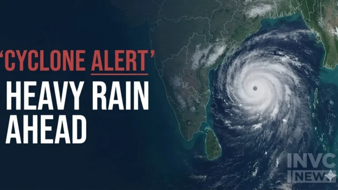
New Delhi, November 16, 2026: Weather conditions across India are set to change as a developing system over the Bay of Bengal is expected to intensify into a cyclonic storm on Monday, November 16, before strengthening further into a severe cyclonic storm on November 17. The India Meteorological Department (IMD) has warned of heavy to very heavy rainfall across parts of southern and eastern India later this week, with coastal Andhra Pradesh, Tamil Nadu and Odisha among the regions facing significant weather risks.
The developing system is also expected to bring strong winds and rough sea conditions over parts of the Bay of Bengal. Meanwhile, a western disturbance is influencing weather patterns over the western Himalayan region, although the latest IMD forecast does not confirm fresh snowfall in Himachal Pradesh and Uttarakhand for November 16.
60-Second Weather Brief
- Bay of Bengal: A depression is likely to intensify into a cyclonic storm on November 16 and a severe cyclonic storm on November 17.
- Andhra Pradesh: Coastal districts could experience heavy to very heavy rainfall on November 19 and 20, with isolated extremely heavy rainfall possible.
- Tamil Nadu: Heavy rainfall is forecast at isolated places on November 17 and 20, with very heavy showers possible on November 18 and 19.
- Odisha: Heavy to very heavy rainfall is likely between November 19 and 21.
- Andaman and Nicobar Islands: Widespread rainfall, thunderstorms and gusty winds are expected during the coming days.
- Himachal Pradesh and Uttarakhand: Isolated rainfall was forecast for November 15, but the latest bulletin does not establish a fresh snowfall alert for November 16.
Bay of Bengal Cyclone Threat: System Could Strengthen Further
The weather system over the southeast and adjoining southwest Bay of Bengal has intensified from a well-marked low-pressure area into a depression.
According to the IMD bulletin issued on November 15, the depression was moving north-northwestwards. It was likely to develop into a cyclonic storm over the central parts of the south and adjoining west-central Bay of Bengal on November 16.
The system is then expected to strengthen into a severe cyclonic storm over the west-central Bay of Bengal on November 17. It may subsequently move northwestwards towards the Andhra Pradesh coast over the following two days.
This developing system has prompted the weather department to issue warnings for coastal regions, particularly as wind speeds and sea conditions are expected to deteriorate.
Heavy Rain Alert for Andhra Pradesh, Tamil Nadu and Odisha
The impact of the developing cyclone is expected to become more significant from November 17 onwards.
Coastal Andhra Pradesh and Yanam are likely to experience heavy to very heavy rainfall at several places on November 19 and 20. The IMD has also warned of isolated extremely heavy rainfall during this period.
Tamil Nadu, Puducherry and Karaikal may experience heavy rainfall on November 17 and 20. Very heavy showers are also possible at isolated locations on November 18 and 19.
Odisha is another state that could face substantial rainfall. The IMD has forecast heavy rainfall at isolated places on November 18, followed by heavy to very heavy rainfall between November 19 and 21.
Thunderstorms and strong winds could accompany the rain in some coastal areas. These conditions may affect road travel, fishing activities and other outdoor operations.
Andaman and Nicobar Islands Face Rain and Strong Winds
The Andaman and Nicobar Islands are also expected to experience unsettled weather as the system develops over the Bay of Bengal.
The IMD has forecast fairly widespread to widespread rainfall between November 15 and 19. Thunderstorms, lightning and gusty winds are also possible.
Squally weather is expected over the Andaman Sea and along and off the islands, with wind speeds potentially reaching 40–50 kmph and gusting up to 60 kmph.
The sea is likely to remain rough to very rough, making marine activities potentially hazardous.
What About Himachal Pradesh and Uttarakhand?
A western disturbance is influencing the weather over parts of the western Himalayan region.
The IMD forecast issued on November 15 indicated isolated to scattered rainfall over Himachal Pradesh, Uttarakhand and Jammu and Kashmir on November 15. Thunderstorms, lightning and gusty winds were also possible at isolated locations in Uttarakhand.
However, the seven-day rainfall forecast indicates predominantly dry conditions in Himachal Pradesh and Uttarakhand from November 16 onwards.
Therefore, reports of fresh snowfall across these two states should be treated cautiously unless supported by a subsequent IMD update. Higher Himalayan areas may experience changing conditions, but a fresh widespread snowfall forecast has not been established in the latest bulletin.
Dense Fog Warning for Uttar Pradesh
While southern and eastern India prepare for changing weather conditions, parts of Uttar Pradesh are facing a separate weather concern.
The IMD has warned of dense fog over isolated areas of the state between November 15 and 17.
Visibility had already fallen below 200 metres at several observation locations, including Bareilly, Kushinagar, Ayodhya and Azamgarh, during the 24 hours ending at 8:30 AM on November 15.
Reduced visibility could affect road and rail movement, particularly during night and early morning hours.
Fishermen Advised to Avoid the Bay of Bengal
The IMD has issued specific warnings for fishermen as wind speeds and sea conditions are expected to worsen.
Fishermen have been advised not to venture into the Andaman Sea, southeast Bay of Bengal, southwest Bay of Bengal and central Bay of Bengal during the respective warning periods extending through November 17–20.
Wind speeds over parts of the central Bay of Bengal could reach 120–130 kmph, with gusts up to 145 kmph from November 18 onwards, according to the forecast.
These conditions underline the importance of following official marine advisories.
What Happens Next?
The next few days will be crucial as the depression develops over the Bay of Bengal. Its movement, intensity and eventual proximity to the Andhra Pradesh coastline will determine the distribution and severity of rainfall across the affected regions.
Residents in coastal Andhra Pradesh, Tamil Nadu and Odisha should monitor district-level IMD warnings and follow instructions issued by local authorities.
Bottom Line: India’s weather pattern is entering an active phase, with a developing Bay of Bengal cyclone posing the biggest concern for southern and eastern coastal states. Heavy rainfall, strong winds and rough seas are expected later this week. Meanwhile, dense fog remains a concern in Uttar Pradesh, while claims of fresh snowfall in Himachal Pradesh and Uttarakhand require confirmation from updated forecasts.
Source: India Meteorological Department (IMD), Ministry of Earth Sciences, press release dated November 15, 2026.