NEW DELHI | August 8, 2026
India Weather Today: Heavy to very heavy rainfall is expected across several parts of the country on Saturday, August 8, as the monsoon remains active over northwest, eastern, northeastern, western and peninsular India, according to the India Meteorological Department (IMD).
The latest forecast points to significant rainfall over Rajasthan, Uttar Pradesh, Uttarakhand, Himachal Pradesh, Odisha, the Northeast and Karnataka, with thunderstorms, lightning and gusty winds also possible in several regions. IMD has advised residents in vulnerable areas to remain alert for waterlogging, localized flooding and other rain-related disruptions.
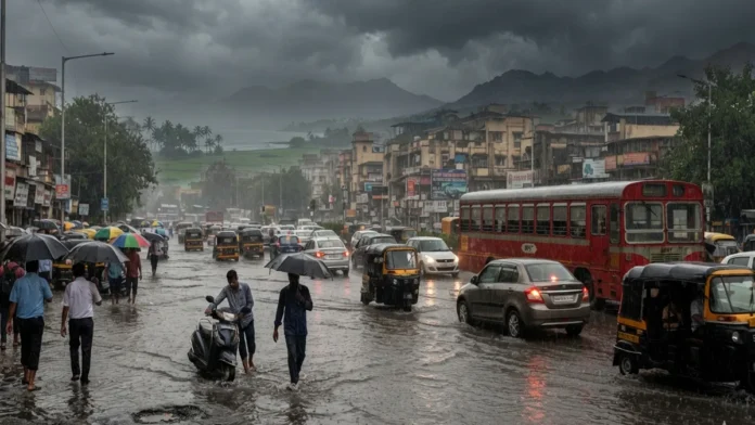
Delhi and the National Capital Region, meanwhile, are recovering from Friday’s intense downpour, which flooded major roads and severely disrupted traffic. Rain remains possible on Saturday, although the latest IMD subdivision warning does not list a heavy-rain warning for Haryana, Chandigarh and Delhi on August 8.
Delhi Weather Today: More Rain Possible, but Intensity May Ease
After a day of torrential rain and widespread waterlogging, Delhi could see additional showers on Saturday.
A broader forecast issued Friday night indicated widespread rainfall over Haryana, Chandigarh and Delhi. However, the updated IMD subdivision warning issued on Saturday shows no heavy-rain warning for the Delhi region, suggesting the intensity may ease compared with Friday’s extreme conditions.
Himachal Pradesh and Uttarakhand Face Heavy Rain Risk
The Himalayan states are expected to remain wet.
IMD has issued a heavy-rain warning for Himachal Pradesh on August 8, with rainfall expected to intensify further early next week. Uttarakhand is also under a heavy-rain warning along with the possibility of thunderstorms and lightning.
Persistent rainfall in hill states can increase the risk of landslides, falling rocks, swollen streams and disruptions on mountain roads.
Travelers in vulnerable districts should monitor local advisories before beginning road journeys.
East Uttar Pradesh and Rajasthan Under Rain Alert
East Uttar Pradesh is under a heavy-rain warning for Saturday, while IMD expects the spell to continue through August 10. West Uttar Pradesh does not carry a heavy-rain warning for Saturday but is expected to see a higher risk from Sunday.
Rajasthan faces a stronger threat.
IMD has forecast heavy rain in West Rajasthan, accompanied by thunderstorms and lightning, while East Rajasthan is under a very heavy rainfall warning for August 8.
The alert raises the possibility of localized flooding and waterlogging, particularly in areas receiving intense rainfall over short periods.
Odisha Could See Very Heavy Rain
Eastern India is also likely to receive widespread monsoon rainfall.
The forecast calls for significant rain across Odisha, Gangetic West Bengal, Sub-Himalayan West Bengal and Sikkim, while Bihar is also expected to remain wet.
Odisha is among the areas facing the more serious rainfall risk, with very heavy rain possible on August 8, according to the national forecast.
Authorities have advised people in flood-prone and low-lying regions to remain alert as repeated rainfall can quickly raise river and drainage levels.
Northeast India to Stay Wet
The monsoon is expected to remain active across northeastern India.
Heavy rainfall is possible at isolated locations in Arunachal Pradesh, Assam, Meghalaya and other northeastern states, according to the latest forecast.
With several northeastern states vulnerable to flash floods and landslides during prolonged spells of rain, residents in hill districts and areas near rivers should keep track of local warnings.
Konkan, Goa, Maharashtra and Gujarat May See Rain
Western India is also likely to experience another wet day.
Widespread rain is forecast over Konkan and Goa, while parts of Maharashtra and Gujarat could also receive showers.
Conditions along the western coast may remain unsettled because of strong monsoon winds and rough sea conditions.
Karnataka Faces Heavy Rain, Thunderstorms and Strong Winds
The southern and peninsular regions are also in the rain zone.
IMD’s updated warning places Coastal Karnataka and South Interior Karnataka under a heavy-rain alert for August 8. Thunderstorms, lightning and strong surface winds are also expected.
Parts of Kerala, Tamil Nadu and Andhra Pradesh may also experience thunderstorms, lightning and gusty winds.
The weather department has advised fishermen against venturing into several affected sea areas, including waters along and off the Karnataka and Kerala coasts, because of adverse marine conditions.
Friday’s Rain Leaves Delhi-NCR Waterlogged
Delhi endured severe disruption on Friday as heavy rain flooded roads, slowed traffic and triggered emergency calls across the capital.
One of the worst-hit stretches was MB Road in South Delhi, particularly near the Air Force Station, where water reportedly reached three to four feet in some areas. Vehicles were stranded and traffic nearly came to a standstill.
Several motorcycles and auto-rickshaws reportedly stalled after entering flooded roads. Air Force personnel were also seen using trucks to move through inundated stretches near the station.
ITO, Rohtak Road and Delhi-Jaipur Highway Hit by Traffic Jams
Traffic disruption was reported across several major routes, including ITO, Wazirabad Road, Patel Road, Rohtak Road, Kirti Nagar, Shaheen Bagh, Peeragarhi and the Delhi-Jaipur Highway.
Waterlogging was also reported near Badarpur Border Metro Station, Vasant Kunj and Sangam Vihar, while flooded underpasses compounded commuter problems.
The Delhi Fire Service also responded to multiple incidents related to the storm, including reports of building collapses and fallen trees. No injuries were reported in those incidents covered by officials.
How Much Rain Did Delhi Receive?
According to IMD data cited Friday, Delhi’s Safdarjung weather station recorded 59.2 mm of rain up to 8:30 a.m., while Lodhi Road received 60.4 mm, Ridge 57 mm, Ayanagar 26.2 mm and Palam 16.9 mm.
Rainfall activity was expected to gradually weaken from Saturday, with lighter rainfall forecast for Delhi over the weekend.
What Should People Watch for Today?
The biggest weather risks on Saturday are concentrated in areas facing heavy to very heavy rainfall, particularly East Rajasthan, Odisha, parts of the Himalayan region and Karnataka.
People traveling through flood-prone cities or hill districts should check local IMD alerts, avoid deeply waterlogged roads and stay away from swollen rivers or streams. During thunderstorms, outdoor exposure in open areas should also be minimized.
The monsoon remains active across a large part of India, meaning localized conditions can change quickly even where no formal heavy-rain warning is in effect.