New Delhi , August 18, 2026
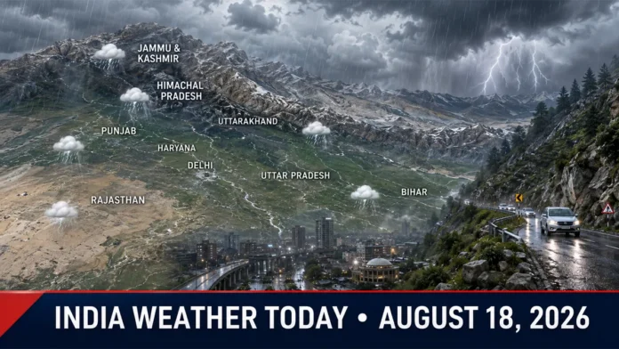
India Weather Forecast August 18, 2026 indicates another active monsoon day across large parts of northern India, with rain, thunderstorms and isolated heavy downpours expected in several states. Residents in vulnerable mountain districts and low-lying urban areas have been advised to monitor local warnings and avoid unnecessary travel during intense rainfall.
The India Meteorological Department has forecast isolated heavy rainfall over Himachal Pradesh, Uttarakhand, Jammu and Kashmir, Haryana, Chandigarh, Delhi, East Rajasthan and West Uttar Pradesh. Punjab, Bihar and several neighboring areas could also receive rain as active monsoon conditions continue.
The latest forecast does not mean that every location in these states will experience heavy rain. Rainfall intensity and timing may vary sharply between districts, with some places recording only light or moderate showers while isolated pockets receive considerably heavier spells.
Heavy Rain Expected in Himachal Pradesh and Uttarakhand
Himachal Pradesh remains among the areas requiring heightened caution. Heavy rainfall is possible at isolated locations, particularly in the hill districts.
Persistent rain can increase the possibility of localized landslides, falling rocks, blocked roads and sudden rises in small rivers and mountain streams. Travelers should confirm road conditions before entering high-altitude or landslide-prone areas.
Uttarakhand may also experience isolated heavy rainfall accompanied by thunderstorms and lightning. People traveling on mountain roads, pilgrimage routes or near river valleys should follow advisories issued by district administrations and local disaster-management authorities.
Rainfall in one district should not be treated as an indication of identical conditions across the entire state. Travelers should check district-specific nowcasts before departure.
Jammu and Kashmir Weather Today
Parts of Jammu and Kashmir are likely to receive light to moderate rain, while isolated locations could experience heavier spells. Thunderstorms accompanied by gusty winds are also possible in some areas.
Rain may temporarily affect visibility and travel on mountain routes. Visitors and local residents should avoid stopping near unstable slopes, fast-moving streams and areas already affected by soil erosion.
Road conditions can change rapidly during mountain rainfall. Therefore, checking traffic and weather updates immediately before a journey is strongly advised.
Delhi Weather: Cloudy Sky and Localized Rain Likely
Delhi is likely to experience a generally cloudy or partly cloudy sky, with rain possible in parts of the National Capital Region. The broader IMD bulletin includes Haryana, Chandigarh and Delhi among regions where isolated heavy rain may occur.
However, Delhi’s city-level forecast indicates that rainfall can remain light and localized at many locations. This distinction is important because a regional warning does not guarantee widespread heavy rain across the capital.
Short, intense showers may still cause temporary waterlogging, slower traffic and reduced visibility in vulnerable areas. Commuters should allow additional travel time and avoid driving through waterlogged underpasses or roads.
Rain may provide brief relief from humid conditions, although high moisture levels could keep the weather uncomfortable between showers.
Haryana, Chandigarh and Punjab Forecast
Fairly widespread rain is possible across parts of Haryana, Chandigarh and Punjab. Cloudy conditions and intermittent showers may continue during the day, with isolated heavy rainfall possible in Haryana and Chandigarh.
Thunderstorms could produce localized gusty winds. However, the latest national bulletin does not support treating 40–60 km/h winds as a uniform forecast across Punjab, Haryana and Chandigarh.
Farmers should avoid unnecessary work in open fields during thunderstorms. Harvested produce, agricultural equipment and livestock fodder should be moved to protected locations wherever intense rain appears likely.
Anyone outdoors should move inside a substantial building after hearing thunder. Trees, metal structures, open fields and isolated shelters do not provide reliable protection from lightning.
Uttar Pradesh Weather: Rain Across Eastern and Western Districts
Both eastern and western Uttar Pradesh may receive rain, with isolated heavy rainfall expected particularly over western parts of the state.
Thunderstorms and lightning may accompany some rain spells. Conditions are likely to vary from district to district, making short-range forecasts and local alerts especially important.
Repeated rainfall may cause waterlogging in poorly drained neighborhoods and affect traffic on urban roads. Rural areas near rivers, drains and low-lying farmland should monitor changes in water levels.
Farmers are advised to postpone irrigation, pesticide spraying and other weather-sensitive field operations where substantial rainfall is expected.
Rajasthan Weather: Eastern Districts Could See Heavy Showers
Eastern Rajasthan is likely to receive rain at several locations, with isolated heavy rainfall possible. Southeastern districts may also experience active monsoon conditions.
Western Rajasthan is expected to see comparatively scattered activity, although isolated light or moderate showers cannot be ruled out. Local thunderstorms may create sharp differences in rainfall even between neighboring districts.
Motorists should remain careful on wet highways, particularly during poor visibility. Waterlogged roads and overflowing seasonal drains should not be crossed without confirming their depth and current.
Bihar Weather: Heavy Rain and Lightning Risk
Rainfall activity is expected to remain active across Bihar, with isolated heavy showers and thunderstorms possible. Lightning remains a significant risk during intense convective weather.
Farmers and agricultural workers should check district-level warnings before entering open fields. Irrigation should be delayed in areas where meaningful rainfall is forecast, helping prevent waterlogging and unnecessary water use.
People should avoid standing beneath isolated trees, near electric poles or in open areas when thunder is heard. Those working outdoors should seek a permanent enclosed shelter until the storm has passed.
Low-lying areas may experience localized water accumulation if heavy rain persists, but this does not mean flooding will occur throughout the state.
Key Weather Risks During the Next 24 Hours
The main potential impacts from active monsoon conditions include:
- Localized landslides and falling rocks in vulnerable Himalayan districts
- Sudden rises in mountain streams and small rivers
- Waterlogging in low-lying urban areas
- Reduced visibility and slower road traffic
- Lightning strikes during thunderstorms
- Temporary disruption on mountain and rural roads
- Damage to unsecured outdoor objects during localized gusty winds
These are potential impacts, not confirmed outcomes for every location.
Safety Advice for Residents and Travelers
Residents should monitor official nowcasts because thunderstorm and heavy-rain warnings can change quickly. Travelers heading to mountain states should check both weather conditions and road advisories before leaving.
Avoid crossing flooded roads, overflowing bridges or fast-moving streams. Even shallow-looking water can conceal road damage or become strong enough to move a vehicle.
During lightning, stay inside a substantial building or a closed vehicle. Unplug sensitive electrical equipment where conditions permit and avoid contact with plumbing during a nearby thunderstorm.
Farmers should secure livestock, protect stored grain and postpone field operations when thunderstorms are approaching. Local administrative instructions should take priority if evacuations, road closures or movement restrictions are announced.
Monsoon to Remain Active Across Northern India
Overall, northern India is likely to experience another wet day on August 18, with the most significant concerns concentrated in isolated heavy-rain zones and vulnerable mountain terrain.
Because monsoon rainfall can be highly localized, readers should use the national outlook as a broad guide and consult district-level warnings for immediate decisions. The IMD forecast is generally valid from 8:30 a.m. on the stated day until 8:30 a.m. the following day. India Meteorological Department forecast bulletin