New Delhi, India — August 20, 2026
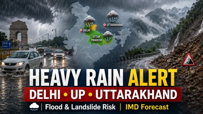
IMD Weather Forecast August 20 2026 indicates another spell of active monsoon conditions across large parts of India, with heavy rainfall expected over several northern, central, eastern, western and northeastern regions. Uttarakhand and parts of Uttar Pradesh remain among the areas requiring particular caution as repeated rain increases the risk of waterlogging, landslides and disruption in vulnerable locations.
The southwest monsoon has remained vigorous across sections of the western Himalayan region, where sustained rainfall has already created difficult conditions in several mountainous areas. Heavy rain can destabilize slopes, swell rivers and streams and disrupt road connectivity, making travel especially challenging in hill districts.
According to recent India Meteorological Department forecasts, widespread or fairly widespread rainfall is expected over several regions during the coming days, with isolated heavy rainfall possible in multiple states. Thunderstorms and lightning may also accompany the rain in some areas.
What Does the IMD Forecast Say?
The latest forecast pattern points to continued monsoon activity across northwest India as well as parts of central, eastern, western and southern India.
IMD’s recent bulletins have indicated heavy rainfall over portions of Uttarakhand, Uttar Pradesh, Madhya Pradesh, Bihar, Odisha, northeastern states, Konkan and Goa, among other areas during the broader August 20-24 period, though intensity and exact locations may vary from day to day.
Residents in vulnerable areas should therefore keep track of district-level alerts because localized intense rainfall can occur even when a wider state forecast calls for scattered or isolated heavy showers.
Uttarakhand Faces Continued Heavy Rain Risk
Uttarakhand remains one of the key areas under watch. IMD forecasts have indicated the likelihood of heavy rainfall in the state during this phase of the monsoon, along with thunderstorms and lightning at isolated locations.
The mountainous terrain makes prolonged rainfall particularly hazardous. Saturated slopes can increase the risk of landslides and rockfalls, while sudden increases in water levels can threaten low-lying roads, bridges and settlements near rivers and streams.
Travelers heading into the hills should check local weather and road conditions before starting their journeys.
Uttar Pradesh Could See More Heavy Showers
Parts of Uttar Pradesh are also likely to remain affected by active monsoon conditions.
Recent IMD outlooks have identified East Uttar Pradesh among areas with potential heavy rainfall during this period, while parts of West Uttar Pradesh may also experience significant showers on selected days.
Heavy rain in densely populated urban areas could lead to temporary waterlogging, traffic congestion and reduced visibility. Rural districts may face localized flooding where drainage is poor or rivers are already carrying high volumes of water.
What Is the Weather Outlook for Delhi?
Delhi has also experienced intense monsoon activity in recent days. IMD’s August 18 forecast material noted very heavy rainfall activity affecting parts of northern India and identified Delhi among locations that had recorded exceptionally intense rain during the active spell.
Rainfall distribution in Delhi can vary sharply across neighborhoods, so residents should rely on short-range city forecasts and nowcasts for the most precise warnings.
Commuters should remain cautious around underpasses and roads known for waterlogging during intense showers.
Himachal Pradesh and Jammu-Kashmir Also Under Watch
The western Himalayan region is expected to remain vulnerable to heavy rainfall.
IMD forecasts have indicated isolated heavy rain over Himachal Pradesh and parts of the Jammu-Kashmir-Ladakh region during this active monsoon phase.
In hill regions, even relatively short periods of intense rainfall can trigger falling debris, rockslides or temporary road closures.
Drivers should avoid unnecessary travel through landslide-prone stretches during intense rain or immediately afterward.
Madhya Pradesh, Vidarbha and Chhattisgarh Rain Forecast
Central India is also likely to see significant monsoon activity.
Recent IMD projections indicate heavy rainfall at isolated locations over parts of West and East Madhya Pradesh, with rain also extending into Vidarbha and Chhattisgarh during portions of the forecast period.
Some areas may experience thunderstorms, lightning and locally intense rain.
Farmers and residents in low-lying areas should keep an eye on local warnings, particularly where soil is already saturated.
Bihar, Jharkhand and Odisha Weather Outlook
Eastern India is expected to remain under an active rainfall pattern as well.
IMD has forecast rain over Bihar, Jharkhand and Odisha during different parts of the August 20-24 period, with isolated heavy rainfall possible in some locations.
Persistent rainfall can increase the threat of localized flooding in areas near rivers, drainage channels and low-lying settlements.
Northeast India Could Receive More Heavy Rain
The northeastern states are also expected to experience widespread monsoon rainfall.
IMD projections point to continued rain across Arunachal Pradesh, Assam, Meghalaya, Nagaland, Manipur, Mizoram and Tripura, with isolated heavy rainfall possible in several areas.
The combination of steep terrain and high rainfall makes landslide-prone locations particularly vulnerable.
Konkan-Goa and Coastal Karnataka to Stay Wet
The western coast is likely to remain active under the monsoon system.
IMD has forecast fairly widespread to widespread rainfall over Konkan and Goa, while Coastal Karnataka is also expected to continue receiving rain during the current spell.
Residents along vulnerable coastal and low-lying stretches should watch for localized water accumulation during intense spells.
Why Flood and Landslide Risks Increase After Repeated Rain
Continuous rainfall over several days can saturate mountain slopes and reduce the soil’s ability to absorb additional water.
That can increase the likelihood of landslides, mudslides and rockfalls in Himalayan states.
In plains and urban areas, intense rainfall over a short period can overwhelm drainage systems and trigger flash waterlogging.
Rivers and seasonal streams can also rise quickly when heavy rainfall occurs upstream.
What Should Residents Do During a Heavy Rain Alert?
People in affected areas should regularly check official IMD and local administration alerts before traveling.
Avoid crossing flooded roads, overflowing streams or submerged bridges, even when water appears shallow.
In mountainous regions, avoid stopping near unstable slopes or beneath areas with visible rockfall.
During thunderstorms, move indoors and stay away from isolated trees, exposed hilltops and open fields.
Those living near rivers or in flood-prone areas should keep essential documents, medicines and emergency supplies ready if local authorities issue evacuation instructions.
How Will the Weather Develop Over the Next Few Days?
The broader monsoon pattern suggests that significant rainfall will continue across several parts of India over the next few days, although the location and intensity of the heaviest showers will shift.
Uttarakhand, Uttar Pradesh, central India, parts of eastern India, the Northeast and the western coast remain among the areas likely to experience active rainfall conditions during the period.
Because monsoon conditions can change rapidly, district-level IMD warnings and short-term nowcasts should be treated as the most relevant source for immediate travel and safety decisions.