
NEW DELHI, India | August 24, 2026 —
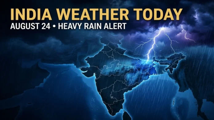
India Weather Today August 24 2026 remains dominated by an active monsoon pattern, with the India Meteorological Department warning of heavy to very heavy rainfall across parts of eastern and central India and a potentially dangerous lightning episode over Bihar.
Odisha faces one of the strongest rainfall risks, while parts of Madhya Pradesh and Chhattisgarh are also under heightened rain warnings.
Uttarakhand, Uttar Pradesh, Jharkhand, Bihar, West Bengal, Maharashtra and several northeastern states are among other regions where heavy rain is possible at isolated locations.
The weather pattern is being influenced by a low-pressure area over the northwest Bay of Bengal and adjoining region, along with multiple atmospheric circulations and the monsoon trough.
Odisha Faces Very Heavy Rain Risk
Odisha remains a major focus of the latest IMD forecast.
The weather department expects isolated heavy to very heavy rainfall over Odisha from August 23 through August 26.
A low-pressure area formed over the northwest Bay of Bengal and neighborhood and was expected to move northwestward across north Odisha and adjoining Gangetic West Bengal.
Heavy rainfall could lead to localized waterlogging, flooding of low-lying areas, reduced visibility and disruption to road traffic.
Residents in vulnerable locations should follow district-level warnings because rainfall intensity can vary considerably from one district to another.
Bihar Faces Moderate to Severe Lightning Activity
Bihar deserves particular attention today.
The IMD has specifically warned of moderate to severe lightning activity over Bihar on August 24.
Heavy rainfall is also likely at isolated locations in Bihar from August 24 through August 26.
During thunderstorms, people should avoid open fields, water bodies and isolated trees. Electrical appliances should be disconnected when severe lightning approaches, wherever it is safe to do so.
Madhya Pradesh and Chhattisgarh Rain Warning
Central India is also experiencing significant monsoon activity.
Fairly widespread to widespread rainfall is forecast over parts of Madhya Pradesh and Chhattisgarh.
West Madhya Pradesh may receive isolated heavy rainfall on August 24, while East Madhya Pradesh is under the possibility of isolated very heavy rainfall during August 23–26.
Chhattisgarh could also experience isolated very heavy rainfall through August 25.
Waterlogging and localized flooding could affect low-lying urban and rural areas if intense rain occurs over a short period.
Uttarakhand and Uttar Pradesh Weather Today
Rain remains active across the Himalayan region and Uttar Pradesh.
Uttarakhand is expected to see widespread rainfall, with isolated heavy rainfall possible through August 24.
In East Uttar Pradesh, isolated heavy rainfall is forecast from August 24 through August 27.
Travelers heading into hill districts should monitor road conditions because intense rainfall can raise the risk of landslides, falling rocks and sudden runoff.
Jharkhand and West Bengal Under Rain Alert
Gangetic West Bengal could receive isolated heavy rainfall on August 24.
Jharkhand is also expected to experience isolated heavy rainfall through August 27, accompanied in places by thunderstorms, lightning and gusty winds.
The same low-pressure system influencing Odisha is contributing to increased rainfall activity across this eastern belt.
Northeast India to Remain Wet
Heavy rainfall is possible at isolated locations across Arunachal Pradesh, Assam, Meghalaya, Nagaland, Manipur, Mizoram and Tripura during the broader August 23–29 period.
Thunderstorms and lightning could accompany rain in several northeastern states.
People living near rivers, steep slopes and other flood- or landslide-prone locations should continue monitoring official local advisories.
Maharashtra Weather Today
Konkan and Goa are likely to receive fairly widespread to widespread rainfall.
The ghat areas of Madhya Maharashtra could experience isolated heavy rainfall through August 25.
Other parts of Maharashtra may receive scattered rainfall, while thunderstorms and lightning remain possible over Marathwada.
South India Weather
The latest IMD outlook indicates relatively subdued overall rainfall activity across Peninsular India during the coming week, but this does not mean every region will remain dry.
Isolated heavy rainfall is still possible on August 24 in parts of:
- Coastal Andhra Pradesh and Yanam
- Tamil Nadu, Puducherry and Karaikal
- Coastal Karnataka
- Kerala and Mahe
- South Interior Karnataka
- Telangana
Thunderstorms, lightning and gusty winds could accompany rainfall in some locations.
Delhi Weather Today: Cloudy Sky and Light Rain Possible
Delhi is likely to see a generally cloudy sky on August 24, with the possibility of very light to light rain at a few places from early morning through the afternoon.
The IMD expects:
- Maximum temperature: Around 33°C to 35°C
- Minimum temperature: Around 24°C to 26°C
- Morning winds: Up to around 15 km/h
- Afternoon winds: Up to around 18 km/h
No widespread severe rainfall event is indicated for Delhi in the latest forecast, although localized showers remain possible.
Rough Sea Warning
Sea conditions are likely to remain rough to very rough over parts of the northwest and adjoining west-central Bay of Bengal and along sections of the West Bengal, Odisha and north Andhra Pradesh coasts through August 24.
Fishermen have been advised to follow official marine warnings before entering affected waters.
IMD Safety Advice
During periods of heavy rain or thunderstorms:
- Avoid flooded roads and low-lying underpasses.
- Do not attempt to cross fast-moving water.
- Avoid taking shelter under trees during lightning.
- Keep away from electrical poles and exposed conductive objects.
- Monitor district-level IMD alerts before traveling into hill regions.
- Move to safer areas if local authorities issue evacuation instructions.
Heavy rainfall can develop quickly and conditions can differ substantially even between neighboring districts.
What Happens Next?
The current monsoon system is expected to maintain significant rainfall over eastern and central India during the next several days.
Odisha remains one of the states requiring close attention through August 26, while Jharkhand and parts of the Northeast may continue experiencing heavy rainfall later in the week.
People should check the latest IMD district warning before making travel plans, particularly in flood- and landslide-prone regions.
Also Read
Also Read: India Weather Alert: Heavy Monsoon Rain Threat Across Multiple States
Also Read: Weather Forecast: IMD Heavy Rain Alert for Delhi, UP, Bihar, Himachal and Uttarakhand











Comments are closed.