By Team INVC | INVC NEWS
Published: September 1, 2026 |09 : 17 AM IST
NEW DELHI, India | September 1, 2026 —
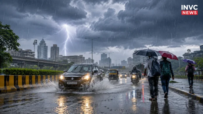
Weather Today September 1, 2026 begins with an intense monsoon spell across several parts of India as the India Meteorological Department warns of extremely heavy rainfall in Chhattisgarh and very heavy rainfall in Odisha and Uttarakhand.
Heavy rain, thunderstorms and lightning are also likely across parts of Uttar Pradesh, Himachal Pradesh, West Bengal and Sikkim, while Delhi, Haryana and Chandigarh face a thunderstorm and lightning threat during the day.
The beginning of September therefore brings two contrasting weather patterns: intense rainfall over parts of central, eastern and northern India, while rainfall activity over much of Peninsular India is expected to remain relatively subdued during the coming week.
Chhattisgarh Faces Extremely Heavy Rain
Chhattisgarh remains among the most vulnerable regions today.
The latest weather warning indicates extremely heavy rainfall at isolated places, accompanied by thunderstorms and lightning.
People living in low-lying areas should remain alert to waterlogging, rapidly rising local streams and difficult road conditions.
The rainfall intensity is expected to ease somewhat from September 2, although heavy rain warnings continue over the region during the next few days.
Odisha Under Very Heavy Rain Alert
Odisha also remains under a significant monsoon threat on September 1.
The state could experience very heavy rainfall along with thunderstorms and lightning at isolated locations.
Persistent rain can increase the risk of waterlogging and local flooding, particularly where the ground is already saturated following recent rainfall.
Rain intensity is expected to gradually reduce after Tuesday, although isolated heavy rainfall can continue into the middle of the week.
Uttarakhand Weather: Very Heavy Rain Raises Landslide Risk
Uttarakhand needs particular caution today.
Very heavy rainfall together with thunderstorms and lightning could affect parts of the hill state.
Heavy rain in mountainous terrain can quickly trigger landslides, falling rocks and sudden increases in water levels in streams and rivers.
Travellers heading towards hill districts should therefore check local road and weather advisories before beginning their journey.
Himachal Pradesh is also under a heavy rainfall warning for September 1.
Uttar Pradesh and West Bengal Also Face Heavy Rain
Both eastern and western Uttar Pradesh could receive heavy rainfall accompanied by thunderstorms and lightning.
The unsettled weather pattern could continue for several days, meaning localised flooding and traffic disruption cannot be ruled out.
Gangetic West Bengal, Sub-Himalayan West Bengal and Sikkim are also under heavy rain warnings today, with thunderstorms and lightning possible in several areas.
Residents should remain cautious during intense lightning activity and avoid taking shelter under isolated trees.
Delhi Weather Today: Thunderstorm and Lightning Possible
Delhi-NCR may not face the same rainfall intensity as Chhattisgarh or Uttarakhand today, but weather conditions can still turn unsettled.
Delhi, Haryana and Chandigarh are under a thunderstorm and lightning warning for September 1.
Cloud cover and isolated rain or thundershowers may develop, while rainfall activity could strengthen from September 2.
People travelling across Delhi-NCR should keep an eye on short-duration weather alerts because thunderstorm conditions can develop rapidly.
Madhya Pradesh Rain May Intensify Later This Week
Western Madhya Pradesh has a thunderstorm and lightning warning today, but the bigger rainfall threat could emerge later.
Heavy rain is forecast from September 2, followed by the possibility of very heavy rainfall between September 3 and September 5.
This makes Madhya Pradesh one of the regions worth closely watching during the first week of September.
September Weather Outlook: Peninsular India May See Less Rain
The nationwide rainfall picture is not uniformly wet.
The latest September weather outlook indicates that subdued rainfall activity is likely to continue across much of Peninsular India during the next week.
This means the strongest monsoon action in the immediate period is likely to remain concentrated over parts of central, eastern and northern India rather than the southern peninsula.
However, local thunderstorms can still develop even in regions where overall rainfall activity remains weak.
Weather Safety Advisory
People in areas facing heavy rainfall or thunderstorms should take basic precautions:
- Avoid flooded roads and overflowing water crossings.
- Stay away from trees, electric poles and exposed areas during lightning.
- Check road conditions before travelling in Uttarakhand and Himachal Pradesh.
- Farmers should secure harvested crops and follow local agrometeorological advisories.
- Keep checking district-level weather warnings because conditions can change quickly.
Also Read – : Weather Today August 31: Extremely Heavy Rain Alert for Odisha, Chhattisgarh
Also Read – : India Weather Today August 23: IMD Heavy Rain Alert Across States
Weather forecasts can change as monsoon systems evolve. Readers planning travel or outdoor activity should check the latest district-level warning before leaving home.