
By Team INVC | INVC NEWS
Published: August 31, 2026 | 08 : 25 AM IST
NEW DELHI, India | August 31, 2026 —
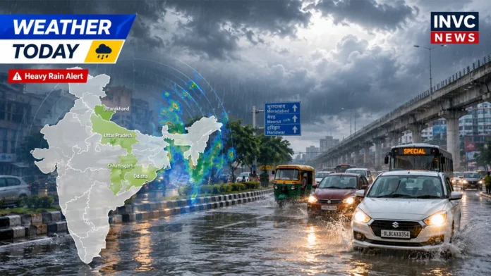
Weather Today August 31 2026 brings a significant monsoon rain threat across eastern, central and northern India, with the India Meteorological Department warning of extremely heavy rainfall at isolated places in Odisha and a serious rainfall spell affecting Chhattisgarh, Jharkhand, Gangetic West Bengal, Uttar Pradesh and Uttarakhand.
The latest Odisha subdivision warning issued on August 31 places the state under an Extremely Heavy Rain warning for Monday, along with thunderstorms, lightning and squally weather. Odisha is expected to remain under a very heavy rain warning on September 1 before rainfall intensity gradually eases.
The wider spell is being driven by a well-marked low-pressure area over the northwest Bay of Bengal and adjoining West Bengal-north Odisha coasts, according to IMD. The system is expected to move west-northwestwards across north Odisha and Gangetic West Bengal.
Odisha and Chhattisgarh Face the Highest Rain Threat
Odisha remains at the centre of today’s weather concern.
IMD’s national outlook had warned of isolated extremely heavy rainfall over Odisha on August 30 and 31, while Chhattisgarh faces the possibility of isolated extremely heavy rainfall on August 31. Heavy to very heavy rainfall is expected more widely across both states during the active spell.
Residents in vulnerable areas should watch local district-level warnings, particularly where intense rain could trigger waterlogging, swollen streams, poor road visibility or disruption to low-lying routes.
The phrase “isolated extremely heavy rainfall” does not mean the entire state will receive rain of the same intensity. It indicates the possibility of exceptionally intense rainfall at some locations within the warned region.
Jharkhand and Gangetic West Bengal Also Under Heavy Rain Threat
The same low-pressure system is likely to produce heavy to very heavy rainfall at isolated places over Gangetic West Bengal and Jharkhand on August 31.
Thunderstorms and lightning are also possible across parts of eastern India.
People travelling through rain-affected districts should therefore check local forecasts before beginning long road journeys.
Also Read – : India Weather Today August 23: Very Heavy Rain Alert Across States
Uttar Pradesh Weather Today: Very Heavy Rain Possible in East UP
Uttar Pradesh also faces an active weather day.
IMD’s Lucknow subdivision warning lists Very Heavy Rain for East Uttar Pradesh on August 31, along with thunderstorms, lightning and squally weather.
West Uttar Pradesh has a Heavy Rain warning for today.
Rainfall is expected to remain active over Uttar Pradesh into the first days of September, meaning repeated spells could increase waterlogging risk in areas that have already received substantial rainfall.
Uttarakhand Faces Very Heavy Rain Risk
The national IMD forecast also points to isolated very heavy rainfall over Uttarakhand on August 31, with the risk continuing into September 1.
In hill regions, intense rain can have a greater impact because of landslide risk, falling debris, rapidly rising streams and disruption along vulnerable roads.
Travellers should check local administration and weather advisories before heading towards sensitive mountain routes.
What Is Causing the Heavy Rain?
IMD has identified several active weather systems.
The most important is the well-marked low-pressure area over the northwest Bay of Bengal near the West Bengal-north Odisha coast.
The monsoon trough is also active, while a western disturbance and other cyclonic circulations are influencing rainfall over different parts of the country.
Together, these systems are supporting widespread moisture and intense rainfall over parts of eastern and central India.
Weather Alert August 31: States to Watch
The strongest rainfall concerns today include:
- Odisha: Extremely heavy rain possible at isolated places
- Chhattisgarh: Extremely heavy rainfall possible at isolated locations
- Gangetic West Bengal: Heavy to very heavy rainfall
- Jharkhand: Heavy to very heavy rainfall
- East Uttar Pradesh: Very heavy rain warning
- West Uttar Pradesh: Heavy rain warning
- Uttarakhand: Very heavy rainfall possible
- Himachal Pradesh: Heavy rainfall risk in parts
Local intensity can differ considerably from district to district, so readers should rely on the latest district and nowcast warnings for their exact location.
What Should Residents Do Today?
People living in districts covered by heavy-rain warnings should avoid unnecessary travel through flooded roads and underpasses.
Drivers should reduce speed during intense rainfall and poor visibility. People in hill areas should be particularly cautious near landslide-prone slopes, while residents of low-lying areas should watch local drainage and river-level advisories.
Lightning is another important risk. Outdoor activity in open fields and near isolated trees should be avoided during thunderstorms.
For the latest official warning for a specific district, readers can check the India Meteorological Department weather warning portal.
Also Read – : India Weather Alert: Mumbai Landslide and Heavy Rain Forecast Across States
What Happens Next?
Odisha is expected to remain under a very heavy rain warning on September 1, before the intensity drops further. Heavy rain may, however, continue over several parts of northern and eastern India into early September.
Because monsoon systems can shift quickly, district-level alerts and nowcasts issued later in the day will be more useful for very short-range decisions than a national forecast alone.











Comments are closed.