NEW DELHI, INDIA | AUGUST 26, 2026 —
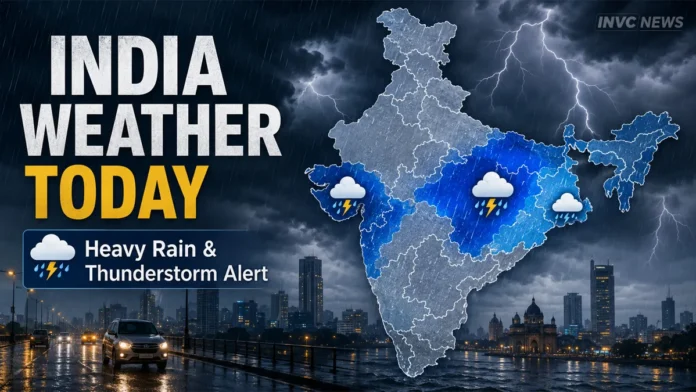
India Weather Today August 26 remains dominated by active monsoon conditions, with heavy rain and thunderstorms forecast across parts of central, eastern and western India. The India Meteorological Department has issued rain and thunderstorm warnings for several regions, while Delhi-NCR is likely to see cloudy weather with localized showers.
West Madhya Pradesh, East Rajasthan, Sub-Himalayan West Bengal and Sikkim are among the areas facing significant rainfall warnings on Wednesday. Madhya Maharashtra is also under a heavy-rain warning.
The weather pattern is not uniform across the country. Some regions could receive intense spells of rain and lightning, while others may see only cloudy skies or short periods of light rainfall.
West Madhya Pradesh Faces Heavy Rain and Lightning
West Madhya Pradesh is one of the key weather zones to watch today.
The IMD’s latest subdivision warning indicates heavy rainfall accompanied by thunderstorms and lightning across parts of the region on August 26.
The heavy-rain warning continues into August 27, although rainfall intensity is likely to vary sharply from district to district.
Residents should remain cautious around waterlogged roads, low-lying areas and overflowing drains. Thunderstorm activity also raises the risk of lightning, particularly for people working outdoors.
East Rajasthan Under Heavy Rain Warning
Parts of East Rajasthan may also experience a wet Wednesday.
The latest IMD warning indicates heavy rain along with thunderstorms and lightning over the eastern part of the state.
This does not mean every district will receive heavy rainfall. Monsoon showers can be highly localized, with one area receiving an intense spell while nearby districts see much lighter rain.
West Rajasthan, meanwhile, does not carry the same subdivision-level heavy-rain warning for today.
West Bengal and Sikkim Rain Alert
Sub-Himalayan West Bengal and Sikkim remain another active monsoon zone.
The IMD has indicated heavy rainfall accompanied by thunderstorm and lightning activity for August 26, with heavy rain remaining possible over the next few days.
People traveling through hill roads should remain alert because repeated rainfall can increase the possibility of localized landslides, falling debris and difficult driving conditions.
Maharashtra Weather Today
Madhya Maharashtra is also under a heavy-rain warning for Wednesday.
Rainfall could affect road travel and lead to temporary waterlogging in vulnerable urban pockets. However, the warning applies to the meteorological subdivision and should not be interpreted as continuous heavy rainfall across every city.
Residents should check district-level updates before making travel plans during periods of intense rainfall.
Delhi-NCR Weather: Will It Rain Today?
Delhi-NCR is expected to see a comparatively mixed weather day.
Skies are likely to remain partly cloudy to cloudy, with the possibility of localized rainfall or thunderstorms. Delhi was around 31°C during the morning, while the day’s maximum is expected to reach roughly 33°C.
A thunderstorm could develop in one or two locations later in the day.
For commuters, this means widespread nonstop rain is not necessarily expected, but a localized shower can still create temporary traffic congestion or waterlogging.
Readers following the changing monsoon pattern can also check our earlier India Weather Today, August 23 coverage, when Odisha, Chhattisgarh and several central and eastern states were under stronger rainfall warnings.
Odisha Rain Risk Increases From August 27
Odisha presents a different weather pattern today.
The latest subdivision warning does not show a heavy-rain warning for August 26. However, the risk increases from Thursday.
Heavy rainfall is indicated for August 27, followed by very heavy rainfall warnings from August 28 through August 30 in the latest outlook.
That makes Odisha an important region to watch over the next several days, especially for travelers and residents in areas vulnerable to waterlogging and flooding.
Our earlier India monsoon and heavy-rain coverage also explains why district-level alerts are more useful than assuming the same rainfall intensity across an entire state.
Why Local Weather Alerts Matter
A state or subdivision-level warning does not mean every location will experience the same weather.
Rainfall intensity can change quickly because of local cloud development, moisture, wind patterns and the movement of monsoon systems.
For this reason, commuters, travelers and farmers should check the latest district-specific forecast instead of relying only on a national weather headline.
The India Meteorological Department regularly updates warnings, nowcasts and rainfall information as conditions change.
Safety Tips During Heavy Rain and Thunderstorms
People in areas facing heavy rain or lightning should avoid unnecessary exposure during intense weather.
Do not take shelter under isolated trees during thunderstorms. Avoid flooded roads, underpasses and overflowing streams, and never attempt to drive through moving water when the depth is unclear.
People living in low-lying areas should keep phones charged and monitor local administration or disaster-management advisories.
Travelers heading toward hill regions should check road conditions before departure because even localized heavy rainfall can trigger temporary blockages or landslide risk.
What to Expect Next
The monsoon pattern will continue to shift over the coming days.
West Madhya Pradesh remains under a heavy-rain warning on August 27, while Odisha’s rainfall risk is expected to strengthen later in the week. Sub-Himalayan West Bengal and Sikkim also remain within an active rainfall zone.
Weather warnings can be upgraded, downgraded or shifted to different districts during the day, so readers should follow fresh IMD updates before traveling.