
New Delhi | October 31, 2026 : India has achieved another significant milestone in its space programme with the successful launch of the NVS-03 navigation satellite aboard the GSLV-F18 rocket. The Indian Space Research Organisation (ISRO) launched the satellite from the Satish Dhawan Space Centre in Sriharikota, Andhra Pradesh, at 11:51 PM IST on October 30. The satellite was subsequently placed into its intended orbit, marking an important step towards strengthening India’s independent satellite navigation capabilities.
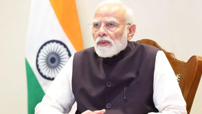
Prime Minister Narendra Modi congratulated ISRO scientists and engineers on the successful mission, praising their dedication and technological capabilities. He described the launch as an important development for India’s indigenous satellite navigation system, Navigation with Indian Constellation (NavIC).
The mission is particularly significant because NVS-03 introduces upgraded navigation capabilities, including an additional L1 frequency signal and indigenous atomic clock technology. These improvements are expected to support the continuity and enhancement of India’s regional navigation services.
PM Narendra Modi Praises ISRO Scientists and Engineers
Reacting to the successful launch, Prime Minister Narendra Modi congratulated the ISRO team through a post on X.
He said that the successful launch of the NVS-03 satellite aboard GSLV-F18 was an important step towards strengthening India’s indigenous satellite navigation system, NavIC.
The Prime Minister also highlighted the satellite’s enhanced capabilities, noting that it would advance India’s efforts to achieve self-reliance in critical technologies and strengthen useful navigation services for people across the country.
Modi praised the dedication and talent of India’s space scientists, stating that their continued efforts were making the nation proud.
The message underlined the strategic importance of developing reliable indigenous space technologies rather than depending entirely on navigation infrastructure operated by other countries.
GSLV-F18 Completes Its 20th Flight
The successful NVS-03 mission also marks the 20th flight of India’s Geosynchronous Satellite Launch Vehicle (GSLV).
The approximately 50-metre-tall, three-stage rocket lifted off from the Second Launch Pad at Sriharikota at 11:51 PM on October 30. It carried the NVS-03 satellite, weighing approximately 2,232 kg, towards a Geosynchronous Transfer Orbit (GTO).
The launch represents another important achievement for the GSLV programme, which plays a significant role in India’s ability to deploy heavier communication, meteorological and navigation satellites.
ISRO confirmed that the rocket successfully placed NVS-03 into its intended orbit.
However, orbital insertion is only one stage of a satellite mission. The spacecraft must undergo further orbital manoeuvres, system checks and commissioning procedures before it can begin providing operational navigation services.
What Makes the NVS-03 Satellite Special?
NVS-03 is the third satellite in India’s second-generation navigation satellite series. Its primary objective is to strengthen the Navigation with Indian Constellation system and help maintain the continuity of India’s regional positioning, navigation and timing services.
The satellite carries several important technological upgrades.
1. Indigenous Atomic Clock Technology
One of the important features of NVS-03 is its indigenous atomic clock, which operates alongside procured atomic clocks.
Atomic clocks are essential for satellite navigation because positioning calculations depend on extremely precise measurements of time. Even very small timing errors can affect the accuracy of location calculations.
The development and deployment of indigenous atomic clock technology are therefore important steps towards reducing dependence on imported critical components.
2. Additional L1 Navigation Signal
NVS-03 introduces the L1 navigation signal in addition to the existing L5 and S-band signals.
The L1 frequency is widely used in satellite navigation receivers, including those found in consumer navigation devices. Its inclusion is expected to improve NavIC’s compatibility with a wider range of modern navigation equipment.
3. Wider Regional Coverage
The satellite is designed to support navigation coverage across India’s landmass and an area extending approximately 1,500 kilometres beyond the country’s geopolitical boundary.
This capability is relevant to transportation, maritime operations, location-based services and other applications requiring accurate positioning information.
What Is NavIC and Why Does India Need It?
NavIC stands for Navigation with Indian Constellation. It is India’s independent regional satellite navigation system, developed by ISRO.
Often compared with the American GPS, NavIC provides positioning, navigation and timing services over India and the surrounding region.
Its coverage extends across the Indian mainland and approximately 1,500 kilometres beyond the country’s boundaries.
NavIC offers two broad categories of services:
Standard Positioning Service (SPS): This service is intended for civilian and general users. It can support applications such as vehicle navigation, location-based services, transportation and personal navigation.
Restricted Service (RS): This is an encrypted service intended for authorised users. It has applications requiring controlled access to navigation information.
An indigenous navigation system is important because it provides India with greater control over critical positioning and timing infrastructure. It also reduces dependence on foreign satellite navigation systems for applications where national reliability and strategic autonomy matter.
Why Is the Second-Generation NavIC Programme Important?
ISRO has planned a series of five second-generation navigation satellites to strengthen the existing NavIC constellation and ensure continuity of services.
NVS-01, the first satellite in this series, was launched on May 29, 2023, aboard the GSLV-F12 rocket. It was notable for carrying an indigenous atomic clock for the first time on an Indian navigation satellite.
The second-generation programme aims to introduce improved technological capabilities, additional signals and more reliable navigation services.
NVS-03 is the third satellite in this upgraded series. Its additional L1 signal and indigenous atomic clock represent important developments in India’s navigation technology programme.
The broader objective is to maintain a dependable regional navigation network for civilian, commercial and authorised strategic applications.
ISRO Chairman Dr V. Narayanan Congratulates the Team
ISRO Chairman Dr V. Narayanan also congratulated the scientists, engineers and people of the country following the successful mission.
The achievement reflects the collective efforts of the scientists, engineers and technical teams involved in developing, preparing and launching the satellite.
The successful deployment of NVS-03 is another step in India’s efforts to strengthen its indigenous space infrastructure and expand its capabilities in advanced navigation technology.
What Happens Next After the Successful Launch?
With NVS-03 successfully placed into its intended transfer orbit, the next stage involves checking the satellite’s health and onboard systems.
ISRO will carry out the necessary orbital manoeuvres to move the spacecraft towards its designated operational position. Engineers will also monitor its communication systems, navigation payload and other critical components.
The satellite will undergo in-orbit testing and commissioning before it is integrated into the operational NavIC network.
Its successful launch is therefore an important mission milestone, but the completion of these subsequent procedures will determine when the satellite can begin delivering operational navigation services.
India’s Growing Space Capabilities
The NVS-03 mission highlights the growing importance of India’s indigenous space technology programme.
From satellite navigation and communication to Earth observation and scientific exploration, ISRO’s missions increasingly support applications that have a direct connection with national infrastructure and everyday life.
For ordinary users, stronger NavIC capabilities could eventually support more reliable navigation services across compatible devices and applications. For businesses and public infrastructure, improved positioning and timing services could benefit transportation, logistics, telecommunications and other location-dependent activities.
The successful GSLV-F18 mission is thus more than another rocket launch. It represents another step towards building an independent and technologically advanced navigation ecosystem.
The Bottom Line: With NVS-03 successfully placed into its intended orbit, India has taken another important step towards strengthening NavIC. The satellite’s upgraded signals and indigenous atomic clock technology could help improve the capabilities of India’s regional navigation system, while reinforcing the country’s long-term ambitions in space technology and self-reliance.