NEW DELHI, India | August 21, 2026
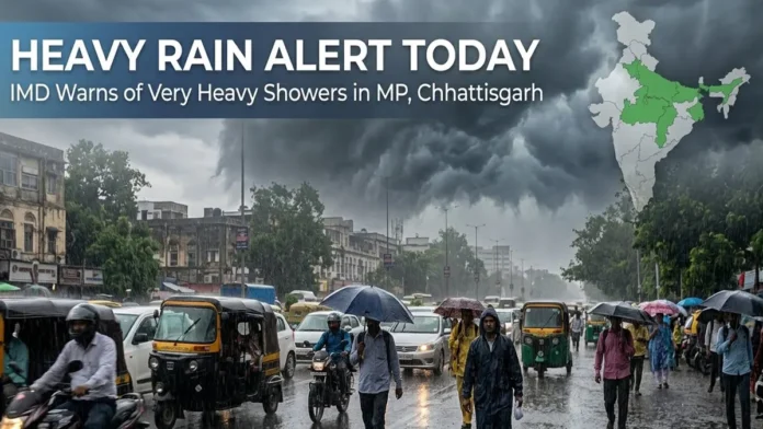
Weather Today August 21 is set to remain dominated by an active monsoon pattern across large parts of India, with the India Meteorological Department warning of heavy to very heavy rainfall in parts of Madhya Pradesh and Chhattisgarh and heavy showers across several other states.
The latest forecast indicates that isolated locations in East Madhya Pradesh and Chhattisgarh could receive heavy to very heavy rainfall on Friday.
Heavy rain is also forecast at isolated places across Uttar Pradesh, Uttarakhand, Himachal Pradesh, Jammu and Kashmir, Bihar, Odisha, West Madhya Pradesh and several northeastern states.
Thunderstorms accompanied by lightning and gusty winds are also possible in parts of eastern, central and southern India.
The widespread weather activity means commuters, tourists and residents in vulnerable areas should closely follow local forecasts and warnings through the day.
Madhya Pradesh Faces the Strongest Rain Warning
East Madhya Pradesh is one of the main areas of concern on August 21.
The IMD has forecast isolated heavy to very heavy rainfall over the region.
A well-marked low-pressure area over northeast Madhya Pradesh and the surrounding region has been influencing the weather pattern.
Recent rainfall has already been substantial in parts of the state.
Rewa recorded 19 cm of rainfall during an earlier 24-hour observation period, while Dindori recorded 15 cm and Gaurihar in Chhatarpur district received 14 cm.
Several other locations in East Madhya Pradesh also reported very heavy rainfall.
With additional rain forecast, areas already saturated by previous showers could be particularly vulnerable to waterlogging and localized flooding.
Chhattisgarh Also Under Heavy Rain Watch
Chhattisgarh is another state where intense rainfall remains a concern.
The forecast calls for heavy to very heavy rainfall at isolated locations.
Persistent rain can increase the risk of waterlogging in low-lying areas and affect road connectivity.
People living close to streams, rivers and vulnerable slopes should pay attention to district-level warnings because rainfall intensity can vary significantly over short distances.
Uttar Pradesh Could See Heavy Rain
Parts of Uttar Pradesh are also expected to receive heavy rainfall.
The forecast includes isolated heavy rain across the state, with the monsoon continuing to influence northern India.
For cities, the biggest immediate concern from intense short-duration rain is often waterlogging and traffic disruption.
Rural areas can face different risks, including overflowing local drains and disruption to agricultural activity.
Residents should therefore follow local nowcasts rather than relying only on the broader state-level forecast.
Uttarakhand and Himachal Pradesh Remain Sensitive
The Himalayan states require particular caution during periods of persistent monsoon rain.
Heavy rainfall is forecast at isolated locations over Uttarakhand and Himachal Pradesh.
In mountain regions, intense rain can create risks beyond ordinary urban waterlogging.
Landslides, falling rocks, rapidly rising streams and disruption to mountain roads can make travel difficult.
Tourists traveling through hill districts should check weather and road conditions before beginning journeys and avoid unnecessary travel through vulnerable stretches during intense rainfall.
Bihar and Odisha in Heavy Rain Zone
Heavy rainfall is also likely at isolated locations in Bihar and Odisha.
Thunderstorms accompanied by lightning and gusty winds of around 30–40 kmph are possible at isolated places in Bihar and Odisha.
Lightning can be particularly dangerous in open areas.
During thunderstorms, people should avoid taking shelter under isolated trees and move indoors when possible.
Farm workers and others spending extended periods outdoors should monitor local thunderstorm warnings closely.
Northeast India to Receive More Rain
The monsoon remains active across northeastern India.
Heavy rainfall is forecast at isolated places over Arunachal Pradesh, Assam and Meghalaya, as well as Nagaland, Manipur, Mizoram and Tripura.
Persistent rainfall across the Northeast can increase the risk of local flooding and landslides, particularly in hilly terrain.
Road conditions can deteriorate rapidly when heavy rain persists for several hours.
Thunderstorms and Gusty Winds Expected
Rain is not the only weather hazard forecast for Friday.
Thunderstorms accompanied by lightning and gusty winds of approximately 40–50 kmph are likely at isolated locations over the Andaman and Nicobar Islands and Andhra Pradesh.
Bihar, East Rajasthan, Jharkhand, Madhya Pradesh, Odisha and parts of West Bengal and Sikkim could experience thunderstorms accompanied by lightning and gusty winds of around 30–40 kmph.
Strong surface winds are also possible over Andhra Pradesh.
Residents should secure lightweight outdoor objects and stay away from exposed locations during strong thunderstorms.
Delhi-NCR Weather: Keep Watching Local Updates
Delhi-NCR does not carry the same heavy-rain emphasis in the latest nationwide August 21 warning as East Madhya Pradesh and Chhattisgarh.
However, monsoon conditions can still produce localized cloud development and short-duration showers across northern India.
Residents of Delhi and surrounding areas should therefore check local IMD nowcasts through the day, particularly before commuting.
A nationwide warning should not be interpreted as meaning every city within a listed region will receive heavy rainfall.
Weather warnings refer to the possibility of specified conditions occurring at isolated or scattered locations.
Fishermen Face Rough Conditions in Some Waters
Marine conditions are also expected to remain rough in some areas.
Squally weather with winds around 40–50 kmph, gusting to 60 kmph, is forecast over the Andaman Sea.
Parts of the Gulf of Mannar, adjoining Comorin area and southwest Bay of Bengal near the Sri Lankan coast could see winds of around 45–55 kmph, gusting to 65 kmph.
People involved in marine activities should follow official coastal and fisheries advisories.
What Does ‘Heavy to Very Heavy Rain’ Mean?
Weather terminology is important when interpreting an IMD warning.
Heavy rainfall generally refers to substantial rain accumulated over a 24-hour period, while very heavy rainfall represents a considerably larger amount.
The impact, however, depends on more than the total rainfall.
A short burst of intense rain over an urban area can cause serious waterlogging, while persistent rain in mountains can destabilize slopes.
So residents should pay attention not only to forecast totals but also to local impact warnings.
What People Should Do Today
People in areas under heavy-rain warnings should monitor local forecasts before traveling.
Drivers should avoid attempting to cross deeply waterlogged roads or fast-moving water.
In mountain regions, travelers should check road conditions and landslide advisories.
During lightning, staying inside a substantial building is safer than remaining in an open field or taking shelter beneath an isolated tree.
Residents should also remember that weather conditions can change rapidly during the monsoon.
Rainfall Pattern to Remain Active
The current spell is not necessarily a one-day event.
IMD’s outlook indicates continued rainfall activity across parts of central, eastern, northeastern and Himalayan India over the coming days.
The location of the heaviest rainfall can shift as weather systems move.
For August 21, however, East Madhya Pradesh and Chhattisgarh remain among the key regions to watch, while heavy rainfall is possible across a much wider belt of the country.
For travelers and commuters, checking district-level forecasts and short-term nowcasts before leaving home remains the safest approach.