
New Delhi | August 3, 2026
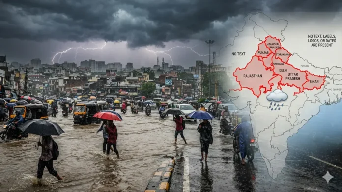
Weather Forecast August 3 2026: The southwest monsoon remains active across North India, with the India Meteorological Department (IMD) forecasting widespread rainfall, thunderstorms, lightning, and gusty winds over several states during the next 24 hours. Heavy to very heavy rainfall is expected in parts of the Himalayan region, while several northern plains are likely to experience intermittent showers and a noticeable drop in temperatures.
Authorities have urged residents in vulnerable areas to remain alert as intense rainfall may trigger flash floods, waterlogging, and landslides.
Heavy Rain Alert for Hill States
According to the IMD, Jammu & Kashmir, Himachal Pradesh, and Uttarakhand are expected to receive moderate to heavy rainfall, with isolated locations likely to witness very heavy downpours.
The weather agency has warned of:
- Landslides in hilly regions
- Flash floods in vulnerable areas
- Rising water levels in rivers and streams
- Travel disruptions on mountain roads
Tourists and pilgrims have been advised to monitor local weather updates before planning travel in the Himalayan states.
Delhi, Punjab, Haryana and Chandigarh to See Rain and Gusty Winds
The national capital and neighboring states are expected to remain under cloudy skies throughout the day.
Delhi-NCR
- Cloudy conditions
- Light to moderate rainfall
- Thunderstorms at isolated locations
- Slight fall in daytime temperatures, providing relief from humidity
Punjab, Haryana and Chandigarh
Residents can expect:
- Intermittent rain showers
- Thunderstorms
- Wind speeds of 40–60 km/h in some areas
- Localized waterlogging in low-lying areas
Widespread Rainfall Likely in Uttar Pradesh
The IMD forecasts widespread rainfall across both Eastern and Western Uttar Pradesh.
Some districts may receive:
- Heavy rainfall
- Thunderstorms
- Lightning
- Strong winds
Residents have been advised to avoid open fields and seek shelter during lightning activity.
Rajasthan to Receive Uneven Rainfall
Rainfall distribution across Rajasthan is expected to vary.
- Eastern and southeastern districts: Moderate to heavy rainfall likely
- Western Rajasthan: Isolated light to moderate showers
The rainfall is expected to improve soil moisture in several agricultural districts.
Bihar Faces Heavy Rain and Lightning Risk
Monsoon activity remains strong across Bihar.
The IMD has forecast:
- Heavy rainfall in several districts
- Thunderstorms
- Lightning
- Gusty winds
Agricultural experts have advised farmers to monitor local weather bulletins before entering fields and to avoid working outdoors during thunderstorms.
Travel and Safety Advisory
Continuous rainfall may lead to:
- Urban waterlogging
- Traffic congestion
- Localized flooding
- Reduced visibility on highways
- Landslides in mountainous regions
State administrations have instructed disaster management teams to remain on standby while emergency response agencies continue monitoring vulnerable areas.
People living near rivers, streams, and landslide-prone slopes have been urged to remain vigilant.
24-Hour Outlook
The IMD expects the southwest monsoon to remain active across much of North India during the next 24 hours.
Weather conditions are likely to include:
- Moderate to heavy rainfall
- Thunderstorms with lightning
- Strong surface winds
- Cooler daytime temperatures in many regions
Meteorologists advise residents to follow official weather updates and local advisories, particularly in areas under heavy rainfall warnings.
Reference Links
- India Meteorological Department (IMD): https://mausam.imd.gov.in/
- Ministry of Earth Sciences (India): https://www.moes.gov.in/
- National Disaster Management Authority (NDMA): https://ndma.gov.in/
Editorial Note
This weather report is based on forecasts and advisories issued by the India Meteorological Department (IMD). Weather conditions can change rapidly; readers are advised to monitor official IMD updates and follow instructions issued by local authorities and disaster management agencies.