NEW DELHI, August 12, 2026
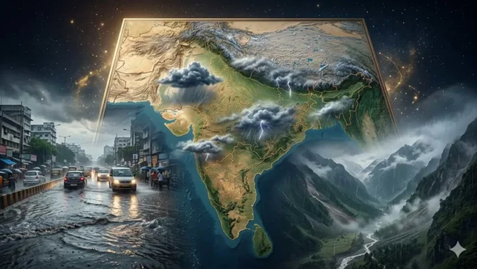
India Weather Today remains dominated by an active monsoon pattern on Wednesday, August 12, with heavy to very heavy rainfall possible in parts of the country and heightened risks of waterlogging, localized flooding and landslides in vulnerable areas.
The India Meteorological Department’s latest national forecast points to particularly significant rainfall over East Rajasthan, while parts of the Western Himalayan region, central India, eastern India, western India and the Northeast are also expected to experience widespread monsoon activity.
The weather pattern is being influenced by an active monsoon trough, a low-pressure system and atmospheric circulation over the Bay of Bengal region, creating favorable conditions for continued rainfall across large parts of India.
Where Is Heavy Rain Expected Today?
East Rajasthan is among the areas facing the strongest rainfall threat on August 12, with isolated very heavy rainfall forecast.
Rainfall is also expected across Jammu and Kashmir, Himachal Pradesh, Uttarakhand, Punjab, Haryana-Chandigarh-Delhi, Rajasthan and other parts of northwest India.
Across central India, widespread rainfall is expected over parts of Madhya Pradesh and Chhattisgarh, while Vidarbha is also likely to experience increased monsoon activity.
In eastern India, rainfall is forecast across West Bengal, Odisha, Jharkhand and adjoining areas. Odisha could experience isolated heavy to very heavy rainfall as a low-pressure area develops around the northwest Bay of Bengal and neighboring areas.
What Is the Delhi Weather Forecast for August 12?
Delhi is expected to remain generally cloudy on Wednesday.
The latest forecast indicates the possibility of a spell of very light rain during the afternoon or evening, with temperatures expected to remain around 34°C to 36°C at the upper end and 24°C to 26°C at the lower end.
Delhi experienced widespread light rain with moderate rainfall at isolated locations during the previous 24-hour period, providing some relief from higher temperatures.
Residents should nevertheless remain attentive to updated local forecasts because monsoon conditions can change rapidly.
What Is the Forecast for Rajasthan?
Rajasthan is one of the major areas to watch on August 12.
The active weather system is expected to bring very heavy rainfall to isolated locations in East Rajasthan, while West Rajasthan could also experience heavy rainfall.
The latest spell follows exceptionally intense rainfall recorded in parts of East Rajasthan during the preceding period.
Persistent rainfall could increase the possibility of waterlogging and localized flooding, particularly in low-lying or poorly drained areas.
Uttar Pradesh and Bihar Weather Today
Rainfall activity is expected across parts of Uttar Pradesh, although the intensity will vary by region.
The broader forecast indicates increased rainfall activity over East Uttar Pradesh later in the week, while scattered rainfall remains possible elsewhere.
Bihar is also likely to experience scattered rainfall before precipitation becomes more widespread later in the forecast period.
Residents should follow district-specific advisories because rainfall and thunderstorm conditions can differ significantly between neighboring districts.
Uttarakhand and Himachal Pradesh Face Landslide Risk
The Western Himalayan region remains particularly vulnerable as widespread rainfall continues.
Heavy rainfall is possible in isolated areas of Himachal Pradesh and Uttarakhand on August 12. Persistent rainfall in steep terrain can increase the risk of landslides, mudslides, falling rocks and disruption to mountain roads.
Travelers heading toward hill stations, pilgrimage routes and remote mountain districts should check local weather and road advisories before beginning their journeys.
Jammu and Kashmir and Punjab Weather
Jammu and Kashmir could receive heavy rainfall at isolated locations, while Punjab may also experience heavy rain in some areas.
Continued rainfall can create localized problems in low-lying areas and affect road movement where drainage becomes overwhelmed.
Travelers and residents in vulnerable areas should monitor local administrative advisories throughout the day.
Madhya Pradesh and Chhattisgarh Rain Forecast
Central India remains under an active monsoon spell.
Widespread rainfall is forecast over parts of Madhya Pradesh and Chhattisgarh. Heavy rainfall may occur at isolated locations, while thunderstorms and lightning remain possible over parts of Chhattisgarh.
Farmers should ensure adequate drainage in fields where prolonged rainfall could cause waterlogging and affect standing crops.
West Bengal, Odisha and Jharkhand Weather
Rainfall activity is expected to remain significant across eastern India.
West Bengal and Odisha are likely to experience widespread rainfall, with isolated very heavy rain possible in some areas. Jharkhand is also expected to see increasing rainfall activity.
Lightning remains another important hazard in parts of eastern India, making it advisable to avoid exposed areas during thunderstorms.
Maharashtra and Gujarat Weather Forecast
Western India will also remain under the influence of active monsoon conditions.
Rainfall is expected across Konkan and Goa, Madhya Maharashtra and Gujarat, with isolated heavy rainfall possible in some areas.
Madhya Maharashtra could receive very heavy rainfall at isolated locations on August 12, while Gujarat may also experience heavy rainfall in places.
Telangana, Andhra Pradesh, Karnataka and Kerala Weather
Southern India is likely to experience mixed but active monsoon conditions.
Rainfall is expected over Telangana, Andhra Pradesh, Karnataka and Kerala, with some areas also facing thunderstorms, lightning and gusty winds.
Coastal Andhra Pradesh, Rayalaseema and parts of Karnataka could experience stronger gusts during thunderstorms. People should avoid taking shelter beneath trees or standing near exposed electrical infrastructure when lightning develops.
Why Is India’s Weather So Active?
Several atmospheric systems are influencing the current monsoon spell.
The monsoon trough remains active, while a low-pressure area has been influencing rainfall across central and northwestern India. An upper-air cyclonic circulation over the northwest Bay of Bengal and neighboring areas is also expected to support the development of another low-pressure area.
These systems are helping sustain rainfall across northwestern, central, eastern and northeastern India as well as parts of the western and southern regions.
Who Should Take Extra Precautions?
People living in flood-prone and low-lying areas should remain alert to rapidly rising water levels during intense rainfall. Travelers in Himalayan states should exercise additional caution because prolonged rain can trigger landslides, mudslides and road blockages.
During thunderstorms, people should stay away from isolated trees, utility poles and exposed open spaces. Farmers should protect standing crops where possible and maintain drainage in waterlogged fields.
Fishermen should also follow official marine advisories before venturing into areas where rough weather or strong winds are forecast.
Weather conditions can change quickly during the monsoon. Residents should therefore rely on the latest district-level warnings and instructions from local authorities before making weather-sensitive travel or outdoor plans.