NEW DELHI, India | September 27, 2026 —
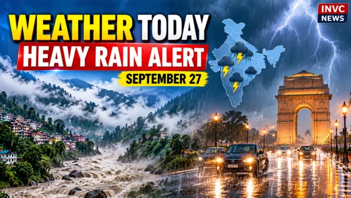
Weather Today, September 27, 2026, remains unsettled across large parts of India as a weakening weather system continues to push moisture into northern and central regions. Uttarakhand faces the most serious rainfall threat today, while Himachal Pradesh, Uttar Pradesh, Delhi-NCR, Haryana and several other regions could see rain, thunderstorms, lightning and gusty winds.
The most intense conditions are expected across the Himalayan region, where heavy rain could increase the risk of landslides, road disruptions and rapidly rising water levels in vulnerable areas.
Meanwhile, Delhi-NCR could experience another spell of rain or thunderstorms after showers helped pull temperatures below normal in parts of the capital region.
THE 60-SECOND BRIEF
Uttarakhand: Heavy to very heavy rainfall, with isolated extremely heavy rain possible.
Himachal Pradesh: Isolated very heavy rainfall and thunderstorms possible.
West Uttar Pradesh: Heavy to very heavy rain may occur at isolated locations.
East Uttar Pradesh: Isolated heavy rainfall is possible.
Delhi-NCR: Rain and thunderstorms remain possible, with gusty winds in parts of the wider region.
Haryana and Chandigarh: Thunderstorms, lightning and gusty winds may affect isolated areas.
Madhya Pradesh: Isolated heavy rainfall and thunderstorms remain possible.
Rajasthan: Parts of eastern Rajasthan could see thunderstorms and lightning.
Uttarakhand Faces the Biggest Weather Risk Today
Uttarakhand is likely to remain the center of the most intense weather activity on September 27.
Heavy to very heavy rainfall is expected in parts of the state, while isolated locations could receive extremely heavy rain.
Continued rainfall over mountainous terrain can increase the possibility of landslides, falling rocks, road blockages and swollen streams.
Travelers heading toward hill districts should check local road and weather conditions before starting their journey.
People living near rivers, streams and steep slopes should also remain alert to rapidly changing conditions.
Delhi-NCR Could See Rain and Thunderstorms
Delhi and the National Capital Region may see another round of unsettled weather today.
Rain and thunderstorms could develop in parts of the region, while gusty winds may accompany stronger storm cells.
Delhi is expected to remain relatively cooler following recent rain.
Daytime temperatures are likely to stay around the low 30s Celsius in many parts of the capital, providing some relief from warmer conditions seen earlier.
Faridabad, Gurugram and neighboring areas may also experience thunderstorm activity.
Uttar Pradesh on Rain Alert
Uttar Pradesh remains one of the key states to watch today.
Parts of western Uttar Pradesh could receive heavy to very heavy rainfall, while isolated heavy rain is possible across eastern districts.
Thunderstorms and lightning may accompany the rainfall.
Residents in low-lying areas should watch for waterlogging, while people traveling by road should remain cautious during intense spells of rain.
Himachal Pradesh May See Very Heavy Rain
Himachal Pradesh is also likely to experience another active weather day.
Very heavy rainfall may occur at isolated locations, along with thunderstorms and lightning.
Rain in hill districts can quickly affect visibility and road conditions.
Drivers should avoid speeding on wet mountain roads and remain alert for falling debris or temporary road closures.
Haryana and Chandigarh: Thunderstorms and Gusty Winds
Haryana and Chandigarh may see thunderstorms accompanied by lightning and gusty winds.
Wind speeds in stronger storm cells could reach around 40 to 50 kmph.
People should avoid standing under isolated trees or near unstable structures during thunderstorms.
Outdoor activities may need to be adjusted if lightning activity develops.
Madhya Pradesh Still Under Weather Influence
Madhya Pradesh could continue to receive rain as the weather system responsible for the current spell weakens and moves north-northwestward.
Isolated heavy rainfall may occur in some areas.
Thunderstorms, lightning and gusty winds are also possible.
Although the system is losing strength, the moisture associated with it can continue producing significant rainfall away from its center.
Rajasthan Could See Thunderstorms
Eastern Rajasthan may experience thunderstorms and lightning at isolated places today.
The western part of the state is expected to see comparatively quieter weather.
However, local thunderstorm development can change conditions quickly, especially during the afternoon and evening.
Maharashtra: Rain Remains Possible
Parts of Maharashtra could continue to see scattered rain today.
Mumbai, the Konkan region and several interior districts may experience cloudy conditions with localized showers.
Rainfall intensity may vary sharply from one location to another.
Motorists in cities should remain prepared for temporary waterlogging if intense showers develop over a short period.
Northeast India Also Stays Wet
Rainfall is expected across parts of northeastern India.
Assam and Meghalaya could see fairly widespread to widespread rainfall, while Nagaland, Manipur, Mizoram and Tripura may also receive rain across several areas.
Arunachal Pradesh could see more scattered activity today before rainfall increases again in some areas.
South India: Thunderstorms Possible in Several States
Parts of southern India may also experience unsettled weather.
Coastal Andhra Pradesh and Yanam could see thunderstorms, lightning and gusty winds.
Rayalaseema, Tamil Nadu, Puducherry, Kerala, Telangana and parts of Karnataka may also receive isolated to scattered rainfall.
In some areas, winds during thunderstorms could become strong for short periods.
Why Is North India Getting So Much Rain?
A depression that was positioned over northeast Madhya Pradesh and adjoining north Chhattisgarh has been moving north-northwestward.
The system is expected to weaken, but its circulation continues to pull moisture across northern India.
At the same time, a western disturbance is influencing weather over the Himalayan region.
These systems are interacting during a period when the southwest monsoon is gradually withdrawing from northwestern parts of India.
That combination is helping produce rain and thunderstorms even as the monsoon withdrawal process continues.
Monsoon Withdrawal Continues
The southwest monsoon has already started retreating from parts of northwestern India.
However, monsoon withdrawal does not mean rainfall ends immediately.
Low-pressure systems, depressions and western disturbances can still produce significant rain during the transition period.
That is exactly what parts of northern India are experiencing now.
Safety Advice for September 27
People in areas under heavy-rain or thunderstorm warnings should avoid unnecessary travel during intense weather.
Stay away from swollen rivers, streams and flooded roads.
Do not shelter under isolated trees during lightning.
In mountainous regions, avoid routes affected by landslides or falling rocks.
Motorists should reduce speed in heavy rain and maintain greater distance from other vehicles.
Travelers should also check local weather and road advisories before heading toward Uttarakhand or Himachal Pradesh.
What Happens Next?
Weather activity across several northern states may begin easing after September 27.
However, Uttarakhand and Himachal Pradesh could continue receiving rain into September 28.
Conditions across Delhi-NCR, Punjab and parts of Uttar Pradesh may gradually improve as the current weather system weakens.
The Himalayan states will remain the key region to watch because additional rainfall over already wet terrain can continue to create local risks.
INVC NEWS Bottom Line
September 27 is shaping up as another active weather day across northern India.
Uttarakhand faces the most serious rainfall threat, while Himachal Pradesh and western Uttar Pradesh could also receive very heavy rain.
Delhi-NCR, Haryana, Madhya Pradesh and several neighboring regions may see thunderstorms, lightning and gusty winds.
For travelers and residents in vulnerable areas, the most important advice today is simple: check local conditions before leaving home and avoid unnecessary travel during intense rain or thunderstorms.