NEW DELHI, India | September 7, 2026 —
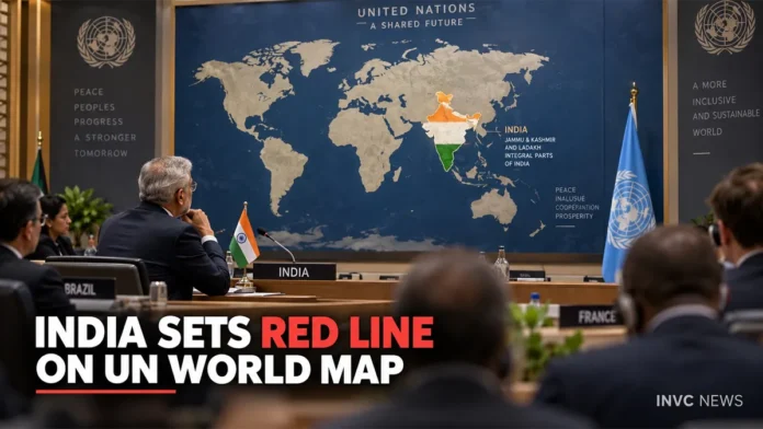
UN World Map discussions have triggered a fresh diplomatic exchange after India backed a United Nations resolution promoting more accurate representation of global landmasses but firmly stated that Jammu & Kashmir and Ladakh must appear in accordance with India’s official map.
The Ministry of External Affairs made clear that India’s vote for the UN resolution does not amount to an endorsement of any particular world map, map projection or depiction of international boundaries.
New Delhi said any inaccurate or misleading representation of India’s territory would remain unacceptable.
The issue gained fresh momentum on Monday after Pakistan rejected India’s position on Jammu & Kashmir, bringing the long-running territorial dispute back into focus as governments debate a new approach to global cartography.
India Makes Its Position Clear on UN World Map
India supported the United Nations General Assembly resolution titled “Correct the Map: Rebalancing Global Cartographic Representation and Promoting Equitable Representation of the World’s Regions, Particularly Africa.”
The UN General Assembly adopted the resolution on September 4.
The initiative seeks to encourage equal-area map projections that show the relative sizes of continents more accurately than traditional projections such as the Mercator map.
However, India drew a clear distinction between supporting more accurate representation of landmass sizes and accepting a particular depiction of national boundaries.
MEA spokesperson Randhir Jaiswal said India backed the underlying principle of equal-area cartographic representation.
At the same time, the ministry stressed that the resolution does not constitute an endorsement of any specific map, projection or depiction of national boundaries.
India also maintained that its sovereign territory, including the Union Territories of Jammu & Kashmir and Ladakh, must appear according to the country’s official map.
India Says Territorial Integrity Is Non-Negotiable
New Delhi framed the issue around sovereignty and territorial integrity.
The government said it would not accept inaccurate or misleading depictions of Jammu & Kashmir and Ladakh.
The clarification carries significance because map projections can address two different issues.
One concerns the mathematical representation of the Earth and the relative size of continents. The other concerns political boundaries, territorial claims and disputed regions.
India said its support applies to the first objective and should not be interpreted as acceptance of any political-boundary representation that conflicts with its official position.
The MEA also pointed out that the UN resolution focuses on equal-area cartography and does not settle questions involving international borders, disputed territories or place names.
What Is the ‘Correct the Map’ Resolution?
The United Nations initiative seeks to address distortions associated with widely used traditional maps.
For centuries, the Mercator projection has played a major role in navigation and education. However, because of the way it projects the globe onto a flat surface, areas closer to the poles can appear disproportionately large.
Africa provides one of the strongest examples of that distortion.
The new push encourages equal-area projections that preserve relative landmass sizes more accurately and give regions, particularly Africa, a representation closer to their actual geographic scale.
Togo spearheaded the resolution with support linked to a broader African campaign for fairer global cartographic representation.
A total of 164 countries voted in favour of the resolution. The United States cast the sole vote against it, while six countries abstained.
India joined the overwhelming majority supporting the measure but attached a clear explanation to its position on political boundaries.
Pakistan Responds to India’s Position
The issue developed into a fresh India-Pakistan diplomatic exchange on Monday.
Pakistan’s Foreign Office rejected New Delhi’s assertions regarding Jammu & Kashmir and reiterated Islamabad’s longstanding position on the territory.
Pakistan Foreign Office spokesperson Sajjad Haider Khan argued that India’s official maps and sovereignty claims do not alter Pakistan’s position on Jammu & Kashmir.
Islamabad also referred again to United Nations Security Council resolutions while restating its demand for resolution of the Kashmir issue according to its interpretation of those resolutions.
India, however, has consistently maintained that Jammu & Kashmir and Ladakh form an integral part of the country and has rejected outside challenges to its sovereignty over the territories it administers.
The competing statements underline how a UN resolution primarily focused on the relative geographic size of continents has intersected with one of South Asia’s most politically sensitive disputes.
Why the New World Map Debate Matters
The debate reaches far beyond the appearance of a classroom map.
Maps influence how people understand geography, political power, economic scale and the relative size of countries and continents.
Supporters of equal-area projections argue that traditional map designs can visually exaggerate some regions while making others appear much smaller than they really are.
The UN initiative attempts to address that cartographic imbalance.
However, the India-Pakistan exchange demonstrates another challenge: changing how the world represents landmass sizes does not automatically resolve political disputes over boundaries.
For India, that distinction remains central.
New Delhi supports the effort to improve geographical proportionality while insisting that cartographic reform must not alter or imply acceptance of territorial boundaries that conflict with India’s official map.
UN Resolution Does Not Settle International Boundaries
One of the most important elements of India’s clarification concerns what the UN resolution actually does.
The resolution encourages a different approach to representing the relative size of global landmasses.
It does not, according to India’s explanation, authenticate a particular political map or decide international territorial disputes.
That distinction matters because a projection determines how the curved surface of Earth appears on a flat map, while political cartography determines borders and territorial labels.
As the global discussion over fairer maps develops, India has made clear that its participation will not change its stated position on Jammu & Kashmir and Ladakh.
The latest exchange with Pakistan has now added a geopolitical dimension to what began primarily as a debate over how accurately the world represents itself on a map.