New Delhi , INDIA — August 17, 2026
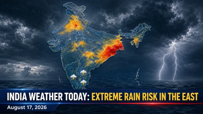
India Weather Today August 17, 2026 is expected to remain stormy across several regions, with the most serious rainfall threat concentrated over Odisha and Gangetic West Bengal. Heavy showers are also forecast in Delhi, Haryana, Punjab, Bihar and parts of central India as the active monsoon continues to influence weather conditions nationwide.
Isolated locations in Odisha and Gangetic West Bengal could receive extremely heavy rainfall on Monday. Such intense rain may trigger waterlogging, localized flooding, traffic disruption and a rapid rise in water levels across vulnerable low-lying areas.
Residents should monitor local advisories and avoid flooded roads, underpasses and swollen waterways. Weather conditions and warnings may be revised during the day.
Odisha and West Bengal Face Highest Rainfall Risk
Eastern India is likely to experience the day’s most severe weather. Extremely heavy rainfall is possible at isolated locations in Odisha and Gangetic West Bengal, according to the latest national forecast.
Heavy rainfall is also expected in Sub-Himalayan West Bengal and Sikkim. Parts of Bihar and Jharkhand may receive intense showers accompanied by thunderstorms and lightning.
The combination of saturated ground and additional rainfall could increase the risk of urban flooding, falling trees and damage to weak structures. Travelers should expect possible delays on roads and railway routes in areas affected by persistent rain.
Delhi Weather Today: Cloudy Sky and Rain Expected
Delhi and the National Capital Region are likely to experience generally cloudy conditions with one or two spells of rain. Light rain may occur at many places, while isolated areas could receive moderate or heavy showers.
Rain is expected to be more active from the morning through the afternoon, with another spell possible during the evening or at night. Haryana, Chandigarh and Punjab also face the possibility of heavy rain at isolated locations.
Commuters should prepare for slower traffic, reduced visibility and waterlogging on vulnerable routes. The detailed Delhi forecast is available in the official regional weather bulletin.
Central India Weather
East Madhya Pradesh faces a risk of very heavy rain, along with thunderstorms and lightning at isolated places. Thunderstorm activity is also possible over West Madhya Pradesh.
Parts of Maharashtra may receive scattered to widespread monsoon showers, although the intensity will vary by region. Localized heavy rain remains possible in some areas.
People working outdoors should move to a secure building when thunder is heard and avoid sheltering under isolated trees or near metal structures.
Bihar, Jharkhand and Northeast India Forecast
Bihar may receive isolated heavy rainfall, with wet conditions expected to continue during the coming days. Jharkhand is also likely to experience heavy rain in some locations.
Widespread or fairly widespread rainfall is forecast across much of Northeast India, including Arunachal Pradesh, Assam, Meghalaya, Nagaland, Manipur, Mizoram and Tripura. Thunderstorms and lightning may accompany some of these showers.
In hilly areas, prolonged rainfall can increase the danger of landslides, falling rocks and sudden disruption on mountain roads.
South India Weather
Tamil Nadu and Puducherry may experience thunderstorms and lightning at isolated locations. Other parts of southern India are expected to see a mixture of localized rain and typical monsoon cloud cover.
Rainfall may be uneven, meaning one neighborhood could receive a sharp downpour while nearby areas remain comparatively dry. Residents should follow city-level nowcasts for short-duration storm warnings.
Weather Safety Advisory
People in rain-affected regions should:
- Avoid driving or walking through flooded roads.
- Stay away from rivers, drains and unstable embankments.
- Unplug electrical equipment if water enters a building.
- Move indoors during thunderstorms and avoid open fields.
- Check traffic and transportation updates before traveling.
- Follow official weather and disaster-management alerts.
The forecast is based on official bulletins issued for August 17. Rainfall intensity and warning areas can change as weather systems develop. Readers can check the national weather forecast and subdivision-level warnings for subsequent updates.