INVC NEWS | National Weather Update | November 3, 2026 : India’s weather is witnessing a major shift on Tuesday, November 3, as Cyclone Murasu makes landfall along the Andhra Pradesh coast, bringing heavy rainfall, powerful winds and the threat of flooding to several vulnerable areas. The impact of the storm is expected to extend beyond Andhra Pradesh, with Telangana, Tamil Nadu, Odisha and Chhattisgarh also facing unsettled weather conditions.
While southern and eastern parts of the country are preparing for another spell of rain and strong winds, northern India is experiencing comparatively stable conditions. Delhi-NCR is expected to remain largely dry, with mainly clear skies and no specific rain warning for the national capital. Temperatures are also beginning to reflect the seasonal transition towards winter.
The developing weather situation has made Tuesday important for coastal communities, commuters, farmers and people living in low-lying areas. The India Meteorological Department (IMD) has issued weather warnings for several regions, while authorities have taken precautionary measures in areas affected by the cyclone.
So, what will the weather be like in your city today? Where is heavy rainfall expected, which states need to remain alert, and what changes are likely over the next 24 hours? Here is the latest India weather report.
Cyclone Murasu Makes Landfall in Andhra Pradesh
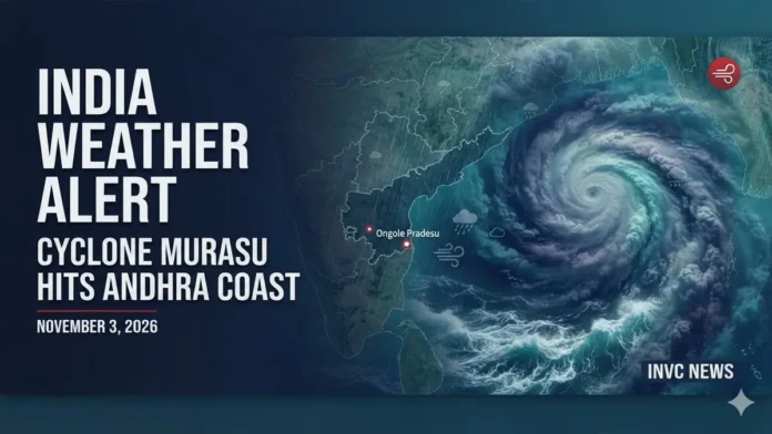
The biggest weather development of the day is Cyclone Murasu, which made landfall near Ongole in Andhra Pradesh’s Prakasam district on Tuesday morning.
According to the India Meteorological Department, the cyclone reached the coast with maximum sustained winds of approximately 100–110 kmph. Heavy rainfall is expected to continue across affected areas as the system gradually weakens after moving inland.
The storm has raised concerns about waterlogging, flash flooding in vulnerable locations, damage to infrastructure and disruption to transport services. Authorities had already evacuated thousands of people from vulnerable locations and suspended some transport operations as a precaution.
The IMD also warned of a possible storm surge of up to 1.5 metres along parts of the coast. Residents in low-lying coastal settlements have been advised to follow official evacuation instructions and avoid exposed coastal areas.
The storm is expected to weaken gradually, but its associated rain bands and strong winds may continue to affect neighbouring states.
Andhra Pradesh Weather: Heavy to Very Heavy Rainfall Expected
Andhra Pradesh is among the states facing the most significant weather impact today.
Coastal districts and Rayalaseema may experience heavy to very heavy rainfall, with extremely heavy showers possible at isolated locations. The districts likely to experience adverse weather include Prakasam, SPSR Nellore, Bapatla, Krishna, Guntur, Eluru, NTR, Palnadu and West Godavari.
The cyclone’s movement inland may also bring strong winds and intense rain spells to areas away from the immediate coastline.
People living near rivers, drainage channels and low-lying settlements should remain cautious. Waterlogging could affect roads and residential areas, while transport services may experience delays.
Fishermen should strictly follow marine advisories and avoid venturing into the sea until conditions improve.
Telangana Weather: Heavy Rain and Strong Winds May Disrupt Daily Life
Telangana is also expected to experience increased rainfall activity as Cyclone Murasu moves inland.
The IMD has forecast heavy to very heavy rainfall at some locations, with extremely heavy showers possible in isolated areas. Khammam, Suryapet, Nalgonda, Nagarkurnool, Wanaparthy, Mahabubabad, Warangal, Jangaon, Karimnagar and Bhadradri Kothagudem are among the districts requiring attention.
Strong winds may accompany thunderstorms and rainfall, particularly during the early hours and morning period.
Residents should avoid unnecessary travel through waterlogged roads and remain alert to local weather warnings. Farmers should also monitor advisories before carrying out outdoor agricultural activities.
Tamil Nadu Weather: Chennai and Coastal Districts on Rain Alert
Tamil Nadu may experience another spell of rain as the weather system affects the southern and eastern coastal belt.
North Tamil Nadu is likely to receive light to moderate rainfall at several places, with heavy showers possible at isolated locations.
Chennai, Tiruvallur, Ranipet, Kancheepuram and Chengalpattu are among the districts covered by weather and wind advisories. Wind speeds of around 40–50 kmph, with gusts reaching 60 kmph, have been forecast in affected coastal areas.
Sea conditions along the northern Tamil Nadu and Puducherry coastline may remain rough to very rough until Wednesday morning, November 4.
People travelling along coastal roads should remain cautious, particularly during periods of heavy rain and reduced visibility.
Odisha Weather: Southern Districts May Receive Heavy Rain
Odisha is another state likely to experience unsettled weather on November 3.
Southern districts, including Malkangiri, Koraput, Rayagada, Gajapati and Ganjam, may receive light to moderate rainfall at many places, with heavy showers possible at isolated locations.
Strong winds may also affect parts of southern Odisha. Wind speeds could reach 50–60 kmph, with gusts of up to 70 kmph in affected areas before gradually easing.
Residents should remain alert to thunderstorms, lightning and possible local flooding.
Chhattisgarh Weather: Rainfall Activity to Continue
Southern Chhattisgarh may experience light to moderate rainfall at several places, with isolated heavy showers possible.
The weather system affecting central and eastern India may continue to influence the state through November 4. Residents should be prepared for changing weather, particularly in areas vulnerable to waterlogging.
Thunderstorms and lightning may also affect some locations. Outdoor activities should be planned carefully when storm warnings are in effect.
Delhi-NCR Weather Today: Mainly Clear Skies, No Rain Warning
Unlike southern India, Delhi-NCR is expected to experience comparatively stable weather on Tuesday.
According to the IMD’s local forecast for New Delhi-Safdarjung, November 3 is likely to bring mainly clear skies, with a minimum temperature of around 16°C and a maximum temperature of approximately 29°C. No specific weather warning has been issued for the capital.
The morning and evening hours may feel relatively cooler, while afternoon temperatures are expected to remain comfortable.
Delhi, Noida, Gurugram, Ghaziabad and Faridabad residents can expect largely dry conditions. However, people should continue to monitor air quality separately, as changing seasonal weather and pollution levels can affect outdoor comfort.
The transition towards winter is becoming more noticeable, particularly during early mornings and late evenings.
Uttar Pradesh and Bihar Weather: Conditions May Remain Unsettled in Some Areas
Parts of eastern Uttar Pradesh and Bihar may experience scattered rainfall as the wider weather system influences the region.
The possibility of local showers means residents should keep an eye on changing conditions, particularly in eastern districts.
Western Uttar Pradesh is likely to experience comparatively more stable conditions, although local forecasts may vary.
People travelling between districts should check the latest district-level weather advisory before setting out.
Himachal Pradesh and Uttarakhand: Cooler Conditions in the Hills
The Himalayan region is gradually moving towards colder seasonal conditions.
Higher-altitude areas of Himachal Pradesh may experience isolated light rain or snowfall, depending on local weather conditions. The plains and lower hill districts are expected to remain comparatively stable.
In Uttarakhand, temperatures may feel cooler during the morning and night, especially in higher-altitude locations. Travellers planning mountain journeys should check local forecasts and road advisories before travelling.
City-Wise Weather Outlook for November 3
| City / Region | Expected Weather |
|---|---|
| Delhi | Mainly clear, dry |
| Noida | Mostly dry |
| Gurugram | Mainly clear |
| Chandigarh | Generally stable |
| Lucknow | Mostly dry; local conditions may vary |
| Patna | Possibility of scattered showers |
| Jaipur | Mainly dry |
| Mumbai | Generally stable; check local forecast |
| Chennai | Rain and gusty winds possible |
| Vijayawada | Heavy rain risk |
| Ongole | Cyclone impact and heavy rain |
| Hyderabad | Rain and thunderstorms possible |
| Bhubaneswar | Rain risk, especially southern Odisha |
| Raipur | Rain in southern parts possible |
| Bengaluru | Check local rainfall advisories |
| Thiruvananthapuram | Local showers possible |
This is a broad regional outlook, not a verified hour-by-hour forecast for every city. Local conditions can differ considerably within the same state.
What Will Happen to the Weather Over the Next 24 Hours?
The next 24 hours will be important for southern and eastern India as Cyclone Murasu weakens after landfall.
The system is expected to gradually lose intensity, but rainfall may continue over Andhra Pradesh, Telangana and neighbouring regions. Parts of Tamil Nadu, Odisha and Chhattisgarh may also receive showers.
Coastal areas will need to remain cautious because sea conditions may take time to improve even after the cyclone weakens.
In northern India, including Delhi-NCR, weather conditions are expected to remain comparatively stable. Cooler mornings and evenings will become increasingly noticeable as November progresses.
The overall weather pattern therefore presents two contrasting situations: cyclone-related rainfall and wind activity in parts of southern and eastern India, and relatively dry, seasonal conditions across much of northern India.
Weather Safety Advisory: What Should People Do Today?
With heavy rainfall and strong winds expected in several regions, basic precautions can help reduce weather-related risks.
- Avoid unnecessary travel in cyclone-affected coastal districts.
- Follow evacuation instructions issued by local authorities.
- Do not attempt to cross flooded roads, bridges or overflowing streams.
- Stay away from electric poles, damaged wires and unstable trees.
- Fishermen should follow official marine warnings and avoid entering rough seas.
- During thunderstorms, move indoors and avoid open fields, isolated trees and exposed rooftops.
- Keep essential medicines, drinking water, mobile phones and emergency supplies accessible.
The most important advice is to follow the latest district-specific bulletins issued by the IMD and local disaster management authorities rather than relying solely on broad national forecasts.
Bottom Line
November 3 is a significant weather day for India, particularly because Cyclone Murasu has made landfall in Andhra Pradesh and continues to influence weather conditions across neighbouring states.
Andhra Pradesh and Telangana face the risk of heavy to very heavy rainfall, while Tamil Nadu, Odisha and Chhattisgarh may also experience unsettled weather. Delhi-NCR, meanwhile, is expected to remain largely dry, with mainly clear skies and temperatures ranging from approximately 16°C to 29°C.
The situation may change as the cyclone weakens and moves inland. Residents in affected areas should stay informed through official weather bulletins and follow local safety instructions.