By Team INVC | INVC NEWS
Published: August 30, 2026 | 09:34 AM IST
NEW DELHI, India | August 30, 2026 —
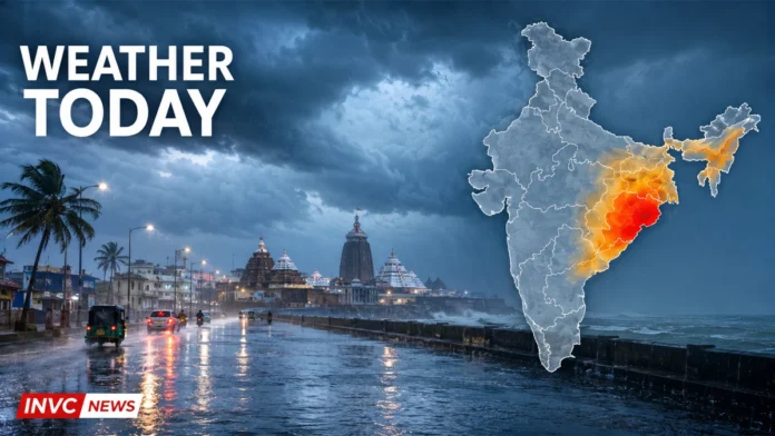
Weather Today August 30 is set to remain severe across Odisha and several parts of eastern and northeastern India. The India Meteorological Department has forecast isolated extremely heavy rainfall over Odisha, while very heavy rain may hit West Bengal, Chhattisgarh, Arunachal Pradesh, Assam and Meghalaya.
The latest warning is linked to a low-pressure area persisting over the northwest Bay of Bengal and adjoining West Bengal–north Odisha coasts. The system is expected to become more marked and move west-northwestwards across northern Odisha and Gangetic West Bengal during the next 24 hours.
Residents in vulnerable districts should remain alert for waterlogging, flash floods, traffic disruption and damage to weak structures.
Odisha at Centre of Today’s Rain Warning
Odisha faces the most serious weather risk on Sunday. The IMD expects heavy to very heavy rainfall, with isolated extremely heavy rain at a few locations.
Extremely heavy rainfall means precipitation of 20.4 cm or more within 24 hours. Such intense rain can rapidly flood low-lying roads, swell local rivers and disrupt rail and road movement.
Thunderstorms accompanied by lightning and gusty winds of 40–50 kmph are also likely at isolated places across Odisha.
People should avoid flooded roads, waterlogged underpasses and unnecessary travel during intense rainfall. Local advisories must take priority because weather conditions can vary sharply between neighbouring districts.
Very Heavy Rain Expected in Several States
Heavy to very heavy rainfall is forecast at isolated locations over:
- Arunachal Pradesh
- Assam and Meghalaya
- Chhattisgarh
- Gangetic West Bengal
Heavy rainfall may also affect Bihar, East Madhya Pradesh, East Uttar Pradesh, Jharkhand, Nagaland, Manipur, Mizoram, Tripura, Sub-Himalayan West Bengal and Sikkim, Uttarakhand and Vidarbha.
Gangetic West Bengal could receive very heavy rain, while thunderstorms and gusty winds reaching 40–50 kmph may accompany the rainfall.
In Bihar, Jharkhand, Sub-Himalayan West Bengal, Sikkim and West Madhya Pradesh, wind speeds could reach 30–40 kmph at isolated locations.
Uttarakhand, Uttar Pradesh and Delhi-NCR Weather
Uttarakhand may experience heavy rainfall, with isolated very heavy showers possible on August 30. Thunderstorms and lightning are also forecast in parts of the state.
East Uttar Pradesh remains under a heavy-rain warning. The wet spell could continue into the first week of September.
For Delhi-NCR and other parts of northwest India, the national forecast indicates isolated to scattered rainfall. However, the latest all-India bulletin does not place Delhi under the same heavy-rain category as Uttarakhand or East Uttar Pradesh.
Commuters should still watch local nowcasts because short, intense showers can cause sudden waterlogging even without a broad heavy-rain warning.
Northeast India Likely to See Widespread Rain
Rainfall will remain widespread across large parts of Northeast India.
Arunachal Pradesh, Assam and Meghalaya may receive isolated very heavy rain. Heavy showers are also likely in Nagaland, Manipur, Mizoram and Tripura.
Thunderstorms and lightning could develop across the region. People in landslide-prone hill districts should avoid vulnerable slopes and follow instructions issued by district administrations.
Rainfall Activity Lower Across Much of South India
Rainfall activity is expected to remain comparatively subdued across much of Peninsular India.
Isolated to scattered rain may occur over Tamil Nadu, Puducherry, Coastal Andhra Pradesh, Telangana, Karnataka, Rayalaseema and Lakshadweep. Kerala and Coastal Karnataka may receive rain at more locations, but the IMD has not issued a widespread heavy-rain warning for southern India for August 30.
Konkan and Goa may witness fairly widespread rainfall, while isolated showers are possible across Gujarat, Madhya Maharashtra, Marathwada and Saurashtra and Kutch.
Fishermen Advised to Avoid Risky Sea Areas
Squally conditions are expected over parts of the Arabian Sea and Bay of Bengal.
Risky conditions may prevail along and off the West Bengal and Odisha coasts and over the northern Bay of Bengal. Fishermen should follow local port warnings and avoid entering areas covered by official advisories.
Precautions During Heavy Rain and Lightning
People in affected states should:
- Avoid trees, electric poles and open fields during lightning.
- Never drive or walk through fast-moving floodwater.
- Keep phones charged and monitor district-level alerts.
- Disconnect electrical appliances if water enters the premises.
- Avoid unnecessary travel during intense rainfall.
- Follow evacuation instructions without delay.
The IMD warning for August 30 remains valid from 8:30 AM today until 8:30 AM on August 31. Readers can check the IMD national weather bulletin and district-wise weather warnings for local updates.