NEW DELHI, INDIA | AUGUST 23, 2026 —
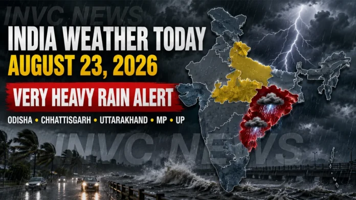
India Weather Today August 23 2026 is dominated by an active monsoon pattern, with the India Meteorological Department issuing very heavy rainfall warnings for Odisha and Chhattisgarh and heavy-rain alerts for several other parts of the country.
The latest subdivision-wise warnings issued Sunday morning show a heightened rain threat over Odisha, Chhattisgarh, Uttarakhand, East and West Madhya Pradesh, East Uttar Pradesh, Jharkhand, Gangetic West Bengal and parts of Northeast India. Thunderstorms and lightning are also expected across several regions.
The IMD’s broader monsoon outlook had also highlighted a developing weather system over the north Bay of Bengal near the West Bengal-Bangladesh coast, increasing the possibility of intense rainfall over eastern and central India.
Odisha Weather Today: Very Heavy Rain Warning
Odisha is among the states facing the strongest weather warning today.
The IMD’s Meteorological Centre in Bhubaneswar has issued a very heavy rainfall warning for August 23, along with thunderstorms and lightning.
The warning remains significant in the days ahead. According to the latest subdivision forecast, very heavy rainfall remains indicated for Odisha through August 29, although the intensity and location of rainfall can vary from district to district.
Residents in low-lying areas should remain alert for waterlogging, while commuters should expect possible delays during intense rainfall spells.
People should also avoid taking shelter under trees or near exposed structures during thunderstorms.
Chhattisgarh Weather: Very Heavy Rain Today
Chhattisgarh is also under a very heavy rain warning for August 23.
Thunderstorms and lightning are possible alongside intense rainfall.
The IMD forecast indicates heavy rainfall continuing from August 24 through August 29, making Chhattisgarh one of the states that could experience a prolonged period of active monsoon weather.
Rainfall could lead to localized flooding, water accumulation and difficult road conditions in vulnerable areas.
Madhya Pradesh Rain Alert
Both eastern and western Madhya Pradesh face heavy rainfall today.
The IMD has issued heavy rain and thunderstorm-lightning warnings for East Madhya Pradesh and West Madhya Pradesh on August 23.
Heavy rainfall remains forecast over West Madhya Pradesh through August 25, while East Madhya Pradesh could continue seeing heavy rain through August 26.
People traveling through areas prone to flooding or overflowing streams should monitor district-level advisories before beginning their journey.
Uttarakhand Weather: Heavy Rain and Thunderstorms
Uttarakhand continues to remain one of the most weather-sensitive regions during the active monsoon spell.
The IMD has issued warnings for heavy rainfall accompanied by thunderstorms and lightning on August 23, with similar warnings continuing through August 29.
The mountainous terrain means even localized intense rainfall can increase the risk of landslides, falling rocks, swollen streams and temporary road blockages.
Travelers, tourists and pilgrims should check local road and weather conditions before heading into vulnerable hill areas.
Uttar Pradesh Weather Today
East Uttar Pradesh is under a heavy rainfall warning today, according to the latest IMD subdivision advisory.
West Uttar Pradesh, however, does not currently carry a subdivision-level heavy rain warning for August 23.
Rainfall may still occur outside officially warned zones, because a subdivision warning does not mean every location outside the warning area will remain completely dry.
Delhi-NCR Weather Today
Delhi-NCR is expected to have a comparatively quieter weather day.
The latest IMD warning chart shows no subdivision-level severe weather warning for Haryana, Chandigarh and Delhi on August 23.
However, Delhi is expected to remain generally cloudy.
The IMD’s four-day Delhi-NCR outlook indicates the possibility of very light to light rain at a few places from morning to noon.
Maximum temperatures are expected to remain around 33°C to 35°C, while minimum temperatures are likely to stay between 24°C and 26°C. Winds could reach around 18 km/h during the afternoon before easing later in the day.
Therefore, Delhi residents may see cloudy and humid conditions with localized showers rather than widespread intense rainfall.
Rajasthan Weather Today
Weather conditions are mixed across Rajasthan.
The IMD has issued a thunderstorm and lightning warning for East Rajasthan on August 23, while West Rajasthan currently carries no subdivision-level weather warning for the day.
East Rajasthan could continue experiencing thunderstorm activity through August 26.
People outdoors should move indoors when lightning activity develops and avoid open fields, isolated trees and exposed rooftops.
Jharkhand Weather: Heavy Rain and Lightning
Jharkhand is also under an active weather warning.
Heavy rainfall accompanied by thunderstorms and lightning is forecast for August 23 and August 24.
Thunderstorm activity could continue beyond the main heavy-rain period.
The combination of saturated ground and repeated rainfall could increase localized flooding risks in vulnerable districts.
West Bengal Weather
Gangetic West Bengal is forecast to receive heavy rainfall with thunderstorms and lightning on August 23 and August 24.
Sub-Himalayan West Bengal and Sikkim face thunderstorm activity today, followed by a heavier rainfall risk from August 24 through August 26.
Rain intensity can vary sharply within the region, so district-level updates should be followed throughout the day.
Assam, Meghalaya and Northeast India
The Northeast also remains under an active monsoon pattern.
Assam and Meghalaya face heavy rainfall with thunderstorms and lightning on August 23, with heavy rainfall warnings extending through August 29 in the latest subdivision forecast.
Other northeastern states may also experience widespread or scattered rainfall and thunderstorms as moisture remains abundant across the region.
Andhra Pradesh and Karnataka Weather
Coastal Andhra Pradesh faces a very heavy rainfall warning today, along with thunderstorms, lightning and strong surface winds.
Rayalaseema is also under thunderstorm and strong-wind warnings.
South Interior Karnataka carries a heavy rain warning for August 23, while Coastal Karnataka could experience thunderstorms, lightning and strong winds.
The latest broader IMD outlook indicates relatively subdued rainfall over much of Peninsular India compared with the more active eastern and central regions, although localized heavy rain can still occur.
Why Is Heavy Rain Increasing?
The current rain pattern is being influenced by multiple monsoon systems.
The IMD’s August 22 national bulletin reported that the monsoon trough was active and highlighted an upper-air cyclonic circulation over the north Bay of Bengal off the West Bengal-Bangladesh coast.
A low-pressure area was expected to form over the region, supporting enhanced rainfall over Odisha and Chhattisgarh.
Another low-pressure system over Madhya Pradesh and cyclonic circulations over northern and northeastern India were also contributing to rainfall activity.
Flash Flood Risk Remains a Concern
The IMD’s flash-flood guidance highlighted a low-to-moderate flash-flood risk in several districts of Chhattisgarh, East Madhya Pradesh, Jharkhand, Himachal Pradesh, Uttarakhand and parts of Northeast India for the period covered by its latest outlook.
Heavy rainfall can rapidly increase surface runoff, especially in saturated or low-lying areas.
Residents should stay away from overflowing drains, rivers and temporary water crossings.
IMD Weather Outlook for August 24–29
The rain threat will not disappear immediately after Sunday.
Odisha: Very heavy rainfall warnings continue through August 29.
Chhattisgarh: Heavy rainfall is forecast through August 29 after today’s very heavy rain warning.
Uttarakhand: Heavy rain and thunderstorms remain a concern throughout the week.
Madhya Pradesh: Heavy rainfall could continue through August 25 in western MP and August 26 in eastern MP.
Assam and Meghalaya: Heavy rain warnings continue through August 29.
West Bengal: Parts of the state could see heavy rainfall through the early part of the week.
Forecasts can change as monsoon systems evolve, and readers should check fresh district-level warnings before making travel decisions.
Safety Advice During Heavy Rain and Lightning
Residents in affected areas should remain alert to rapidly changing local conditions.
- Avoid flooded roads, underpasses and low-lying areas.
- Do not attempt to drive through moving floodwater.
- Stay away from rivers, drains and swollen streams.
- Avoid standing beneath trees during thunderstorms.
- Keep phones charged and emergency contacts available.
- Travelers in hill states should confirm road conditions before departure.
- Fishermen should follow the latest coastal and marine warnings.
- Follow instructions issued by local authorities and disaster-management agencies.
Also Read
Also Read: India Weather Alert: Mumbai Landslide, Heavy Rain Threat Across States
Also Read: Weather Forecast Today: IMD Heavy Rain Alert for Delhi, UP, Bihar, Himachal and Uttarakhand
Also Read: India Heavy Rain Alert: Kashmir Cloudburst, Roads Closed as Monsoon Intensifies
What Travelers Should Know Today
Anyone traveling through Odisha, Chhattisgarh, Madhya Pradesh, Uttarakhand, East Uttar Pradesh, Jharkhand, West Bengal or Northeast India should check district-level forecasts shortly before departure.
Weather warnings describe conditions across broad areas, and rainfall can be much heavier in one district than another.
For Delhi-NCR, no major subdivision warning is currently in place, though cloudy skies and isolated light rain remain possible.
Overall, India Weather Today August 23 2026 shows the strongest rain risk shifting toward eastern and central India, while Uttarakhand and parts of the Northeast continue to face persistent monsoon-related hazards.